This is the third part of an exploration of Jumieges in Turner’s footsteps. Here we trace the viewpoints of his pencil sketches.
Right click image and select open image in a new tab. Close tab to return to this page


Jumièges, from a Steamboat on the River Seine, ?1829
Tate, London,
Tancarville and Lillebonne sketchbook, TB CCLIII 59a; Tate D23815
Image courtesy of Tate
https://www.tate.org.uk/art/artworks/turner-jumieges-from-a-steamboat-on-the-river-seine-d23815
Working upstream, the first in sequence is a sketch in the Tancarville and Lillebonne sketchbook TB CLIII 59v. This records Jumieges Abbey looking up the river from the north. There is a group of figures in the foreground that we might presume to be fellow-passengers on a steamboat. Two of them, indeed – one standing at the centre, and another resting on what appears to be a trunk towards the right – might even be sketching.
Best viewed full size. Right click image and select open image in a new tab. Close tab to return to this page

Turner made two further sketches on the opposite page as the boat approached the abbey, TB CLIII 60r and on the later visit he redrew exactly the same prospects of the abbey in the Seine and Paris sketchbook, TB CCLIV 71r.

Two sketches of Jumièges Abbey from the north, ?1829
Tate, London,
Tancarville and Lillebonne sketchbook, TB CCLIII 60r; Tate D23816
Image courtesy of Tate
https://www.tate.org.uk/art/artworks/turner-two-views-of-jumieges-d23816

Two sketches of Jumièges Abbey from the north, 1832
Tate, London,
Seine and Paris sketchbook, TB CCLIV 71r; Tate D24021
Image courtesy of Tate
https://www.tate.org.uk/art/artworks/turner-ruins-and-hills-at-jumieges-normandy-d24021
The upper sketch on this page repeats the prospect seen over the passengers on TB CCLIII 59v, and the lower sketch from an almost identical viewpoint to the lower sketch on TB CCLIII 60r.
Best viewed full size. Right click image and select open image in a new tab. Close tab to return to this page

The loop of the river on which Jumieges Abbey stands is encircled by an impressive amphitheatre of wooded banks. When Leitch Ritchie visited Jumieges to write the text for ‘Turner’s Annual Tour’ he was particularly struck by the setting:
‘On the opposite bank of the Seine, the form of the land changes instantaneously. A rampart of black hills, crowned with trees circles round the peninsula, with the river between, like the inner ditch of some fortress of giants. This singular rampart is flanked by a series of buttresses, which, only for their enormous size, we would set down at once as artificial fortifications. They are ridges, diverging at regular intervals from the hill to the water’s edge, and pointing towards the rounded end of the peninsula.’
On the next page of the Tancarville and Lillebonne sketchbook, TB CCLIII 60v, the artist sought to record something of the relationship.

Four sketches of Jumièges Abbey from the north, ?1829
Tate, London,
Tancarville and Lillebonne sketchbook, TB CCLIII 60v; Tate D23817
Image courtesy of Tate
https://www.tate.org.uk/art/artworks/turner-views-of-jumieges-d23817
The next page, TB CCLIII 61r, records details of the abbey whilst passing along the western arm of the meander.
Four sketches of Jumièges Abbey, from the north-north-west (right), north-west (centre), and west (top right), plus a detail of the crossing tower (top left), ?1829
Tate, London,
Tancarville and Lillebonne sketchbook, TB CCLIII 61r; Tate D23818
Image courtesy of Tate
https://www.tate.org.uk/art/artworks/turner-views-of-jumieges-d23818
This is the nearest approach to the abbey, so Turner also tried to set down as much of the abbey ruins as he could make out. He took details from the north, north-west and west. He managed to get down some outline impressions but from the river the west front remains three-quarters of a mile distant.

In truth the views of the abbey from the river are fitful. It is hidden by every intervening tree, and even when occasionally in full view, is beyond comfortable visibility. On board a steamboat the amount of detail that Turner could see was limited, but the time available to set it down was also pressured. There is no record, for example, of the fine Romanesque arcading on the square bases of the towers, nor any correct record of the number of bays of the nave, or of the openings in the west front or crossing tower.

Tate, London,
Seine and Paris sketchbook, TB CCLIV 70v; Tate D24020
Image courtesy of Tate
https://www.tate.org.uk/art/artworks/turner-ruins-at-jumieges-normandy-d24020

Tate, London,
Seine and Paris sketchbook, TB CCLIV 70r; Tate D24019
Image courtesy of Tate
https://www.tate.org.uk/art/artworks/turner-ruins-at-jumieges-normandy-d24019
In 1832 Turner re-recorded glimpses of the abbey from the north and north-west across two pages of the Paris and Seine sketchbook TB CCLIV 70v and 70r, but these seem even more pressured than his earlier efforts. At least he did appear in f.70v (upper page, above) to record the number of clerestory windows – ‘8’.
Right click image and select open image in a new tab. Close tab to return to this page

Viewpoints of c.1829 (yellow) and 1832 (red)
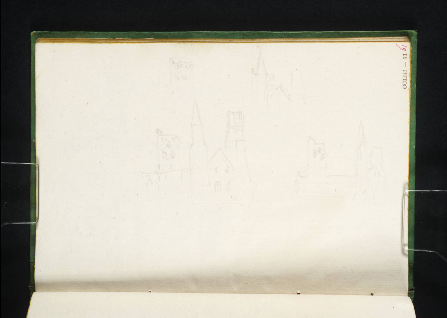
On his first visit, Turner took his final sketches at Jumieges from the river to the south-west of the abbey. TB CCLIII 61v. Here, he records a view downstream along the western reach of the meander, with the abbey facing the wooded banks across the river. Even though at this point the abbey was over a mile off, he attempted to set down a detail from this angle. Below, on the same page, he turned away from the abbey to look upstream to make a sketch of the banks encircling the south bank of the meander.

Upper sketch; Jumièges Abbey from the south-east with a detail of the abbey above
Lower sketch; The banks of Jumieges, looking south to a windmill at Barneville sur Seine
Tate, London,
Tancarville and Lillebonne sketchbook, TB CCLIII 61v; Tate D23819
Image courtesy of Tate
https://www.tate.org.uk/art/artworks/turner-views-of-jumieges-d23819
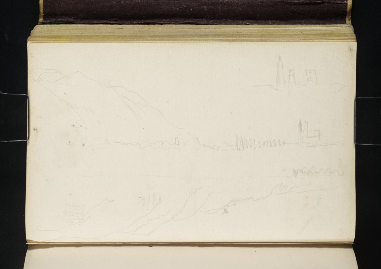
Upper sketch; Jumièges Abbey from the south-east with a detail of the abbey above
Lower sketch (upside down); The banks of Jumieges, looking south to a windmill at Barneville sur Seine
Tate, London,
Seine and Paris sketchbook, TB CCLIV 69v; Tate D24018
Image courtesy of Tate
https://www.tate.org.uk/art/artworks/turner-ruins-and-hills-at-jumieges-normandy-d24018
Turner’s final sketches in the Paris and Seine sketchbook are an almost uncanny replay of the earlier observations. TB CCLIV 69v takes the view of the abbey along the river from almost exactly the same south-east angle as the sketch in the Tancarville and Lillebonne sketchbook TB CCLIII 61v. As in the earlier sketch, he also sets above it an architectural detail, although the abbey is so far distant that there is little more information in the detail than in the wider view. That done, he then turns to scan the banks looking upstream. We must turn the page to make the comparison, but the similarity with the earlier sketch is striking. He even managed to centre both sketches on the windmill overlooking the river.
Click on either image to open full-size in gallery view. Close gallery (x) to return to this page.


We can identify the windmill. It stands in the vicinity of Barneville sur Seine. There is a well-known belvedere here now offering an astonishing panorama of the entire Jumieges meander and the encircling ramparts [photgraphed by Edward Tap for Google Streetview]. No windmill survives in this area today, but there is one in the right vicinity marked on an ?early C17 map at ‘des Cotes’:
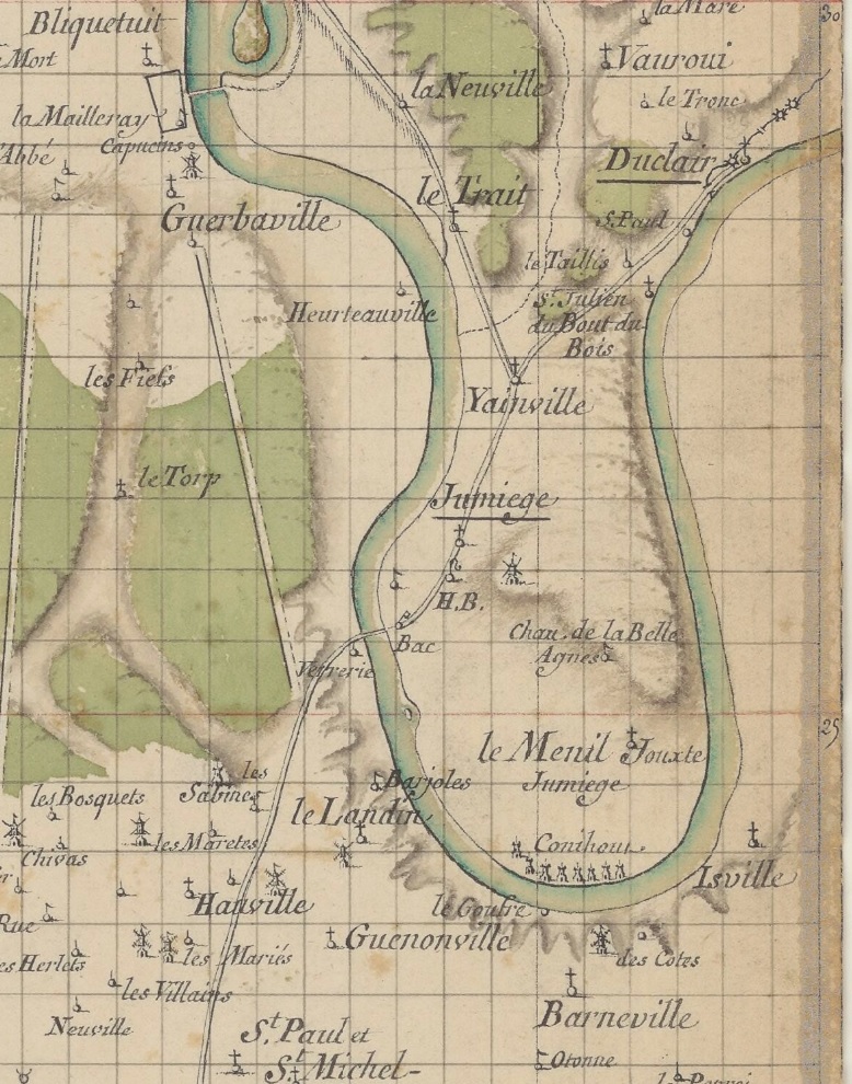
The French National Land register of 1826 records three windmills in this vicinity
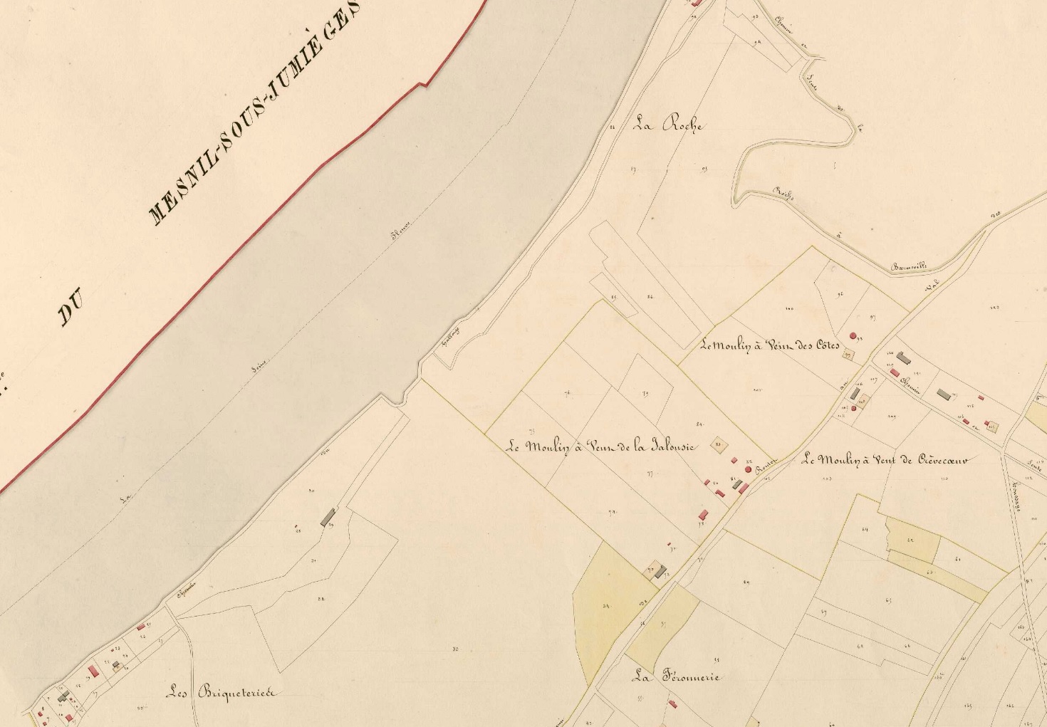
The Normandy Heritage site (Inventaire patromoine normandie) records: ‘The windmills of Côtes, Jalousie and Crèvecœur are shown in section B of the 1826 land register. They were all three located a few dozen or hundreds of meters apart on the heights overlooking the Seine. The windmill of Jalousie, destroyed in 1863, had belonged to the Saint-Georges de Boscherville abbey since 1203. The windmill of Côtes, which was located at the current site of the panorama, was destroyed in 1850. The millers’ houses still exist on the other side of the Côtes path. The Crèvecœur windmill, built near the current pond, was destroyed in 1879.’
The windmill in Turner’s sketch is presumably that of Cotes, since that stood nearest to the escarpment edge.
Even recognising the topographical interest of the subject, and that the escarpment lends such character to the whole site, it is remarkable that Turner reprised his sketch activity so exactly. It is almost as if he was dissatisfied with the results of the first visit and hopeful that he might find something more on the second. But the circumstances and the pace of progress, lead him inevitably to go through almost exactly the same motions. In effect, although he had passed the abbey twice, in some respects he had not been there at all.