Here we resume our journey through Turner’s Between Lucerne and Thun sketchbook. At the end of the previous instalment we left the artist watching the sun rise over the head of the Brienzersee. The reason he was up so early was to give himself a full day to explore the Haslital. Here he records a sequence of waterfalls along the valley as he makes his way up to Meiringen.
Best viewed full size. On a desktop right click and open in a new tab. Close tab to return to this page
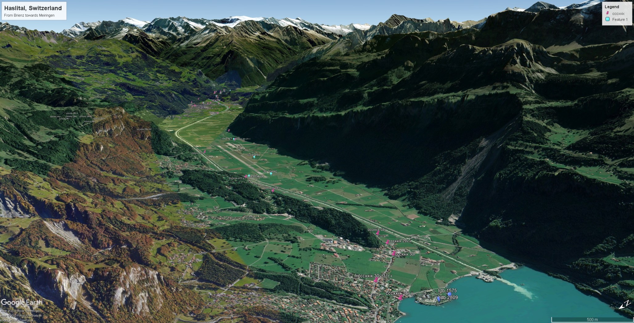
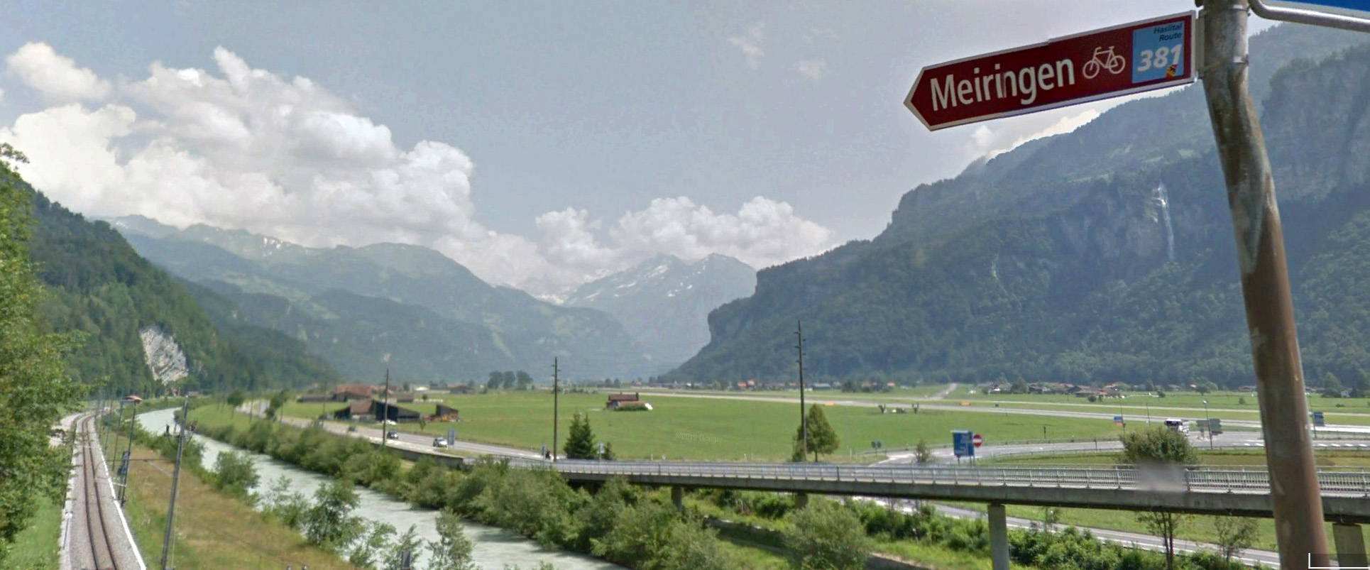
Haslital is the name given to the valley of the river Aare running from its debouchment into Lake Brienz to high into the mountains and the Grimsel Pass leading to the upper Valais. Another branch leads over the Susten Pass and thence to the northern part of the St Gotthard route at Wassen. It was a major transit route from prehistoric times connecting the major valleys in this part of Switzerland and offering routes to and from Italy. Turner explored the lower valley as for as Meiringen. Here the terrain is flat and alluvial, hemmed in between valley sides varying between the craggy and the precipitous, over whose cliffs various mountain rivers throw themselves in vertical plumes of 100m or more. The route from Brienz followed the Brunig route as for as the foot of the pass, and then crossed to the left (south) side of the Aare on the old Wylerbrigg, now a major modern road junction. The old road then proceeded along the south side of the valley, no doubt following ground that offerd some resilience to the Aare’s frequent propensity to flooding. As a result the river had recently been embanked into a canal, allowing the land to be farmed more securely.

Best viewed full size. On a desktop right click and open in a new tab. Close tab to return to this page
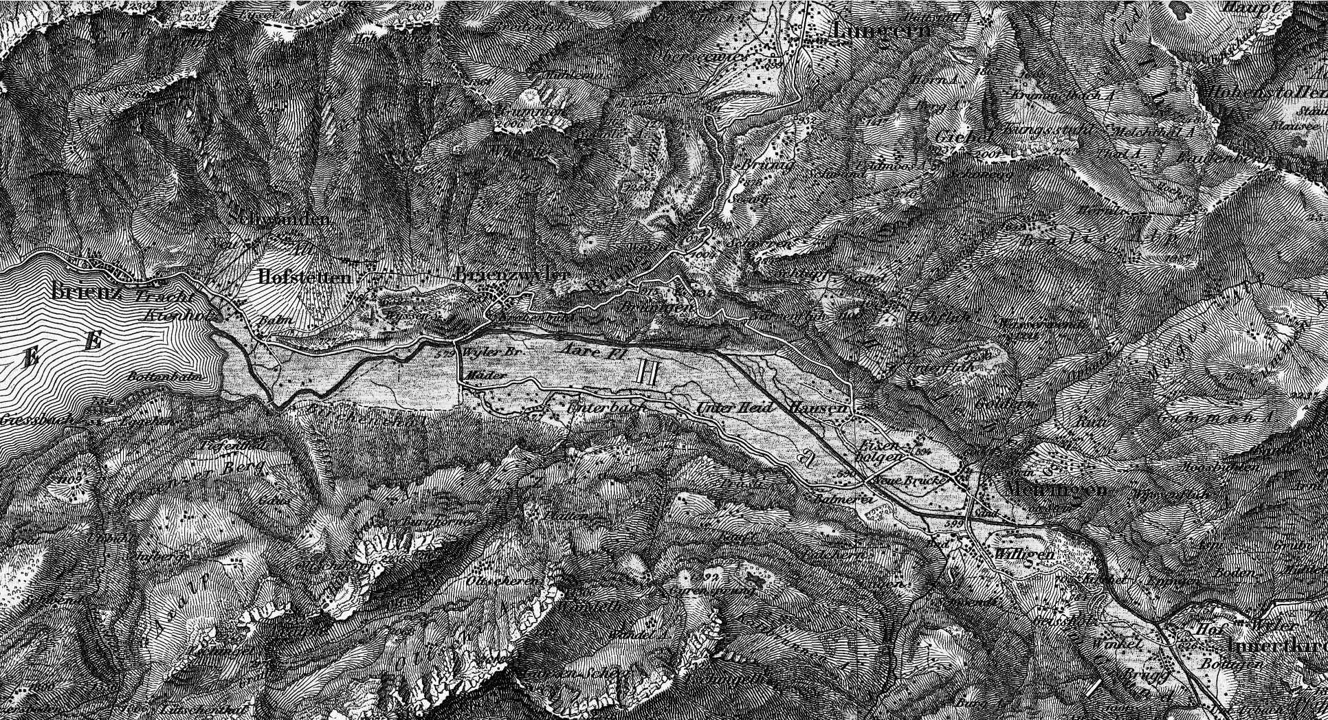
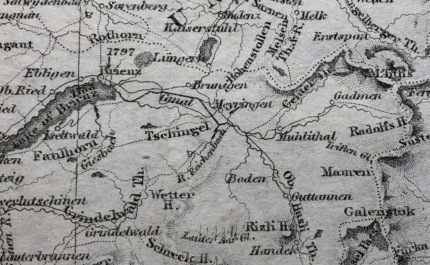
We can see the routes in Turner’s time, albeit at very large scale, in an engraved map published in Beattie and Bartlett’s Switzerland Illustrated in 1836. We can also see the topography in one of the first large-scale surveys published in 1864. The head of the valley is closed by a wedge of mountains that rise to the Dammastock (3630m) and the snowfields of the Rhone and Trift glaciers. The route to the upper valley above Meiringen then picked its way over a rocky ridge through which the Aare had cut a deep and narrow gorge. Just before here, the road crossed another bridge up to Meiringen, and then returned across a bridge near the mouth of the gorge. Turner surmounted the ridge to take a view into the upper valley. The distances are not great: It is about eight miles from Brienz to Meiringen; today less than 15 mins by train or in a car but still no more than three hours ambling slowly enough to take in the scenery all around.
Turner explored the valley in 1802, but on that occasion his principal interest was in the Reichenbach Falls near Meiringen, and he made a major study of that. He made time besides only for a couple of pencil sketches at Meiringen itself. We will see those in due course as part of our exploration of the village.

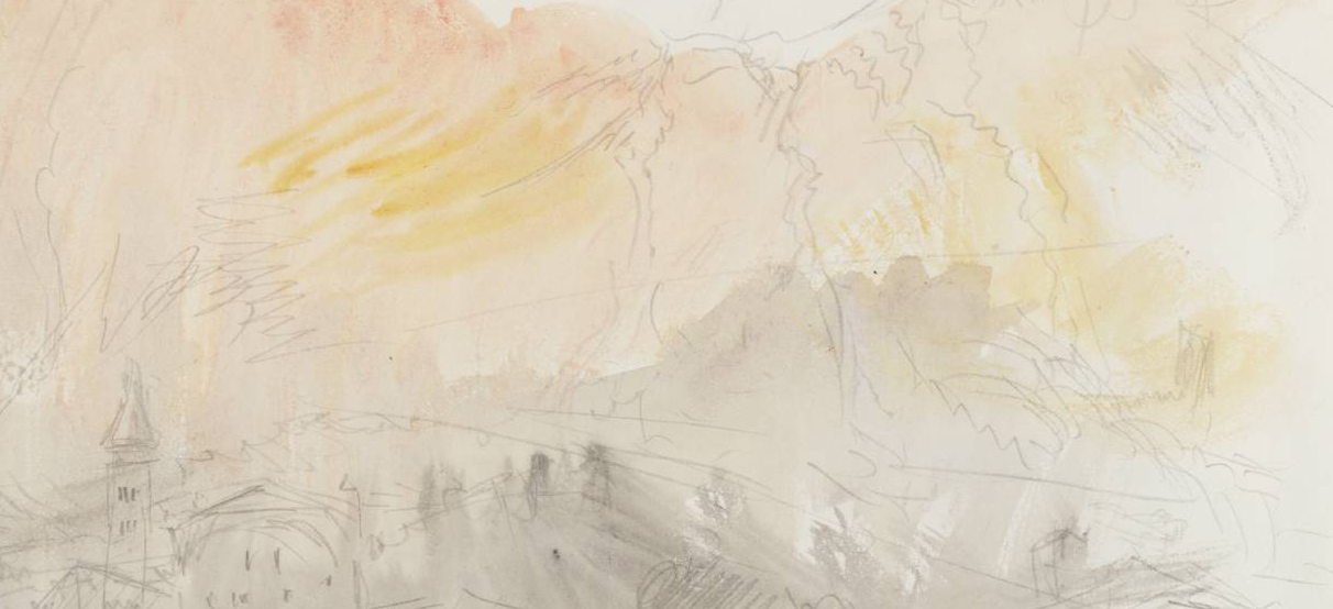
No return trip is known before 1841, but the Turner Bequest at Tate Britain in London contains a hitherto undiscussed clutch of drawings of Haslital subjects. These are drawn in pencil on a felty wove grey paper with a distinctive greenish-yellow tint. Four of these were identified as showing views in the Meiringen valley by A J Finberg in his Inventory of the Turner Bequest published in 1909, but no further consideration of them has ever been published. Here, however, I can supply more specific detail and identify a total of nine sheets carrying a total of eleven subjects. The surviving sheets compose together into a single full sheet of paper, subsequently divided into eight pieces, and one of those sheets was further subdivided into two. It is perhaps not immediately obvious that these must belong to the same tour as the sketches in the Between Lucerne and Thun sketchbook: They are calmer in temper and more expansive, and observe their topographic details more patiently. They do, however, follow the range of subjects in the sketchbook quite closely. Furthermore, three subjects record subjects that occur later in the Between Lucerne and Thun itinerary; two record the Giessbach falls on Lake Brienz, and a third the church at Thun. This implies that that they were made in parallel, or that Turner made two more-or-less identical tours in different years. If this is the same tour, the difference in temper may be accounted for by recognising that Turner used the sketchbook to mark his initial encounter with possible subjects and the larger sheets for more considered studies of selected subjects. As we shall see, there is occasionally some close comparison of sketchbook and grey paper treatments of subjects, so we will treat both formats as we visit each site in order.
Turner was also back in the area in 1844, his last visit to Switzerland. I have several new identifications to offer in the Meiringen and Grindelwald Sketchbook (Tate, Turner Bequest CCCXLVII), but detailed consideration of that will best given separately to the present tour. Those subjects will, I think, be of great interest to anyone interested in this area so I do hope to be to list them in a postscript, and in due course to study them to the extent that they deserve.
Best viewed full size. On a desktop right click and open in a new tab. Close tab to return to this page
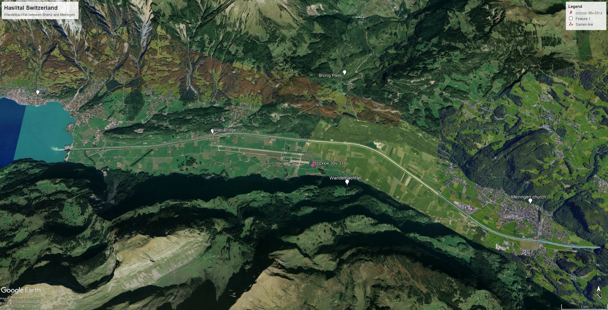
Turner’s route retraced the road by which he had arrived at Brienz as far as the Wilerbrucke over the River Aare near the foot of the Brunig pass road. From there he had an open panorama up the valley. On his return, he used the grey paper to make several sketches in this area, which we will consider in due course, but for now he continued across the bridge and along the road on the south side of the valley. He appears to have been keen to reach Meiringen as quickly as possible, so he was half way there before he stopped to make a sketch in the sketchbook.
Best viewed full size. On a desktop right click and open in a new tab. Close tab to return to this page

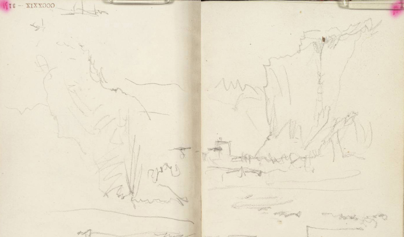
He stopped just short of the hamlet of Unterheid, where the steep cliffs on the right appear at their most dramatically overhung, and just where the Wandelbach throws itself 130m from their crest into the valley.
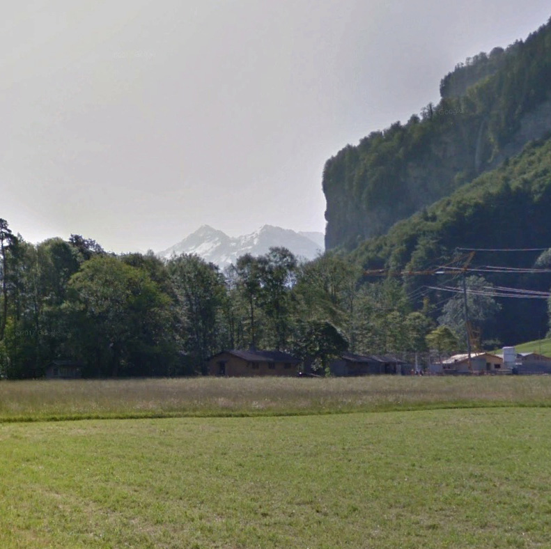
The vertical cliff wall makes a foil for the mountains closing the valley – the wedge of the Pfaffenchopf (1849m) and its ridge beyond leading left to the summit of the Mahrenhorn (2924m), framed on the left by the slopes descending from the Brunig. It clearly had dramatic appeal, but not quite enough at this point to detain Turner for a more careful record of the distant mountain profiles.
Best viewed full size. On a desktop right click and open in a new tab. Close tab to return to this page
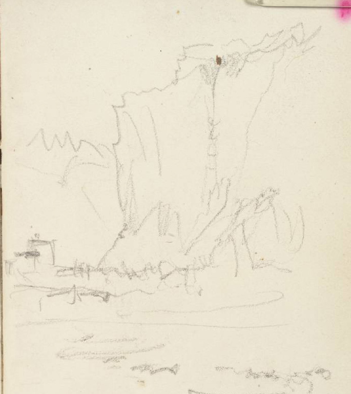
His next stop was a couple of kilometres further where the 125m horsetail Falcherenbach fall comes into view. Here, the crags of the south side of the Haslital rear up dramatically in foreshortened perspective and in the distance we can see the peaks at the head of the valley with the closer viewpoint now bringing the wedge of the Pfaffenchopf into prominence with the Mahrenhorn beyond left. To the right of the Pfaffenchopf Turner notes a glimpse of ‘Snowy peaks’ [if that is the correct reading of the inscription] which can be identified as the Diechterhorn (3388m) down whose northern slopes flows the Trift glacier. It is remarkable that, even in his late sixties, the glimpse of a snowy peak could still thrill Turner’s attention.
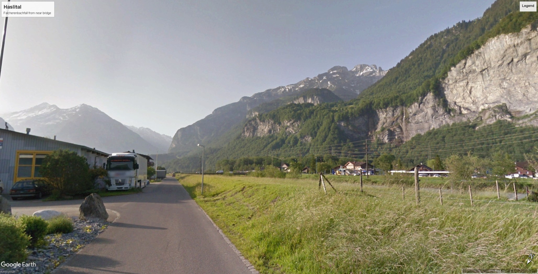

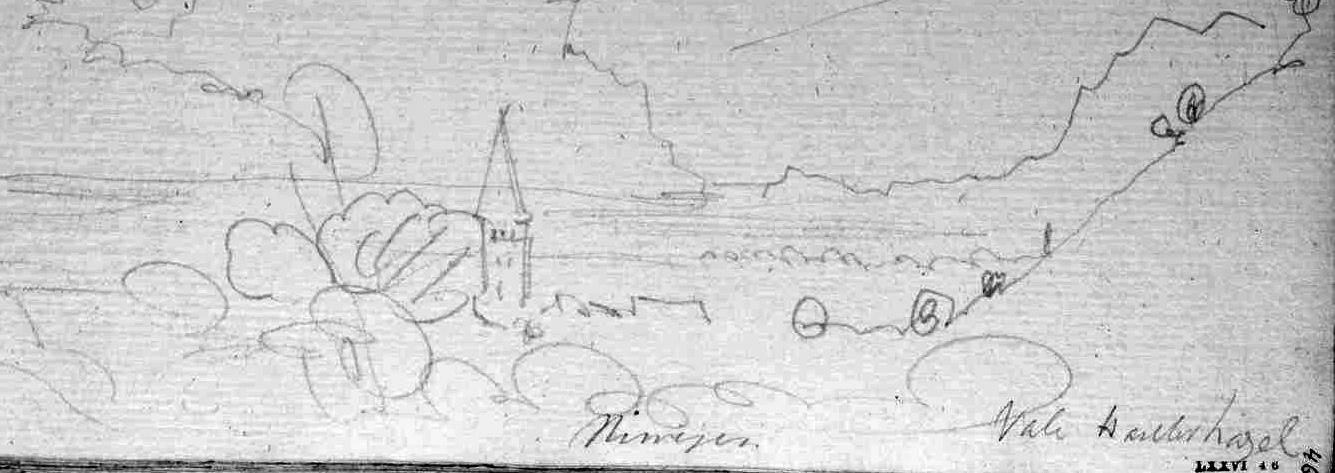
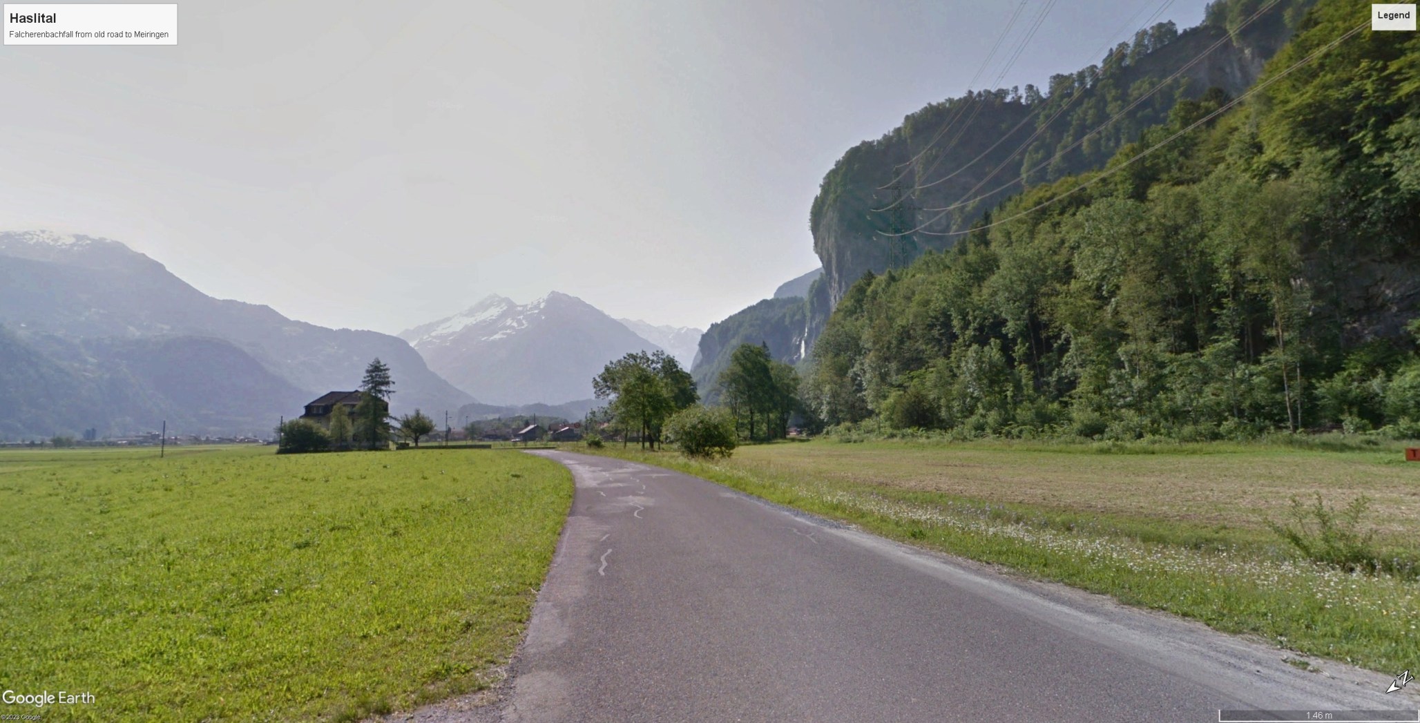
Another kilometre brought Turner to the Neue Brucke over the river Aare and he crossed towards Meiringen on the northern bank. Before heading for the village he made a little detour on the road towards the Brunig Pass in order to take a more expansive view of the Falcherenbach falls and the south side of the valley. The centre of the composition is dominated by the fluted crest of the Englehorns, but it is still the glint of snow on the distant Diechterhorn that attracts his special notice.


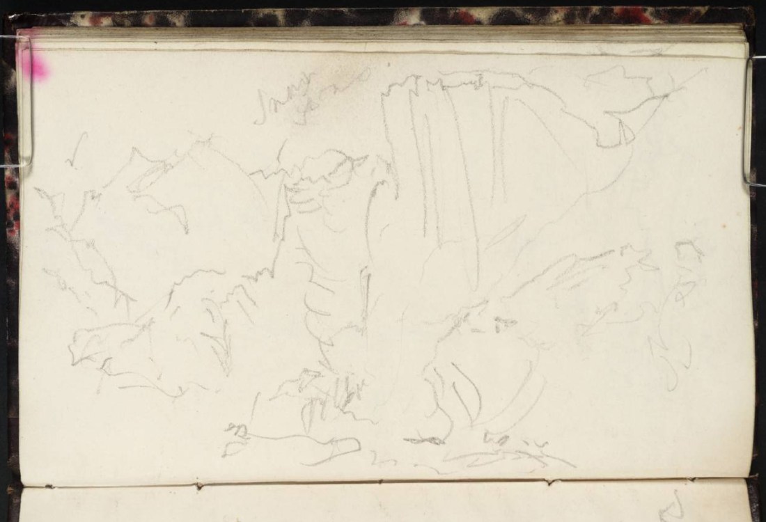
From the same viewpoint or close by, the artist turned over the page to continue the panorama of the valley to the right in order to take in the sharp profiles of the crags descending into the valley towards Brienz. He noted the relationship between the two sketches by inscribing the word ‘Falkern’ at the left, even though the waterfall itself is some way left of the present field of view. His immediate attention, however was caught by a number of women passing by on the ‘Road’ dressed in traditional costume. He was particularly struck by one at the right wearing a ‘Red Cap’. Another kilometre would bring them all to Meiringen.

