Here we continue our journey through Turner’s Between Lucerne and Thun sketchbook. In this instalment we follow the artist down to the entrance to the Aare Gorge (Aareschlucht) and pick our way up the old mule track leading above the gorge to the upper valley, and take views looking back down the valley.
Best viewed full size. On a desktop right click and open in a new tab. Close tab to return to this page
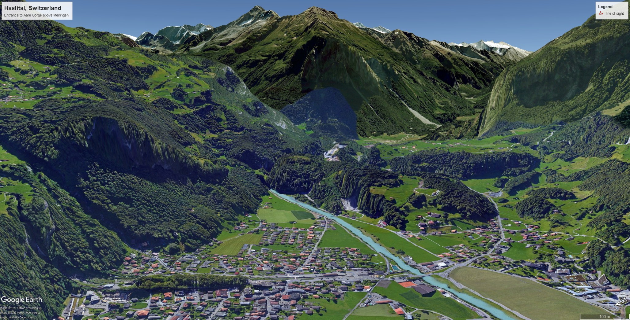
A mile or so above Meiringen the Haslital narrows and is crossed by a ridge of hard limestone called the Kirchet. In geological time this has proved resistant to the ebb and flow of glaciers. As successive ice ages have retreated, a lake has formed above the ridge and the meltwater eroded a deep and narrow gorge through the rock. It is less than one metre wide in places and well over fifty metres high. In 1889 a walkway was made through the gorge, partly on suspended planks and partly in tunnels, and the site rapidly became established as one of the principal natural wonders of the region.
Aareschlucht website: click on link below to open in new page

There was no such access in Turner’s day, and little publicity. The popular tourist account of Switzerland, William Brockedon’s, Passes of the Alps, 1829, Vol 2, [Route from Lucerne to Domo Dossola by the Grimsel and the Gries, pp. 4-5] mentions it only in passing: ‘In ascending towards the Grimsel from Meyringen, the head of the plain is shortly attained, and thence the road rises rather abruptly above a deep fissure cut by the Aar through the rocks which separate, like an embankment, the vale of Meyringen from that of Imgrund.’
William Beattie’s Switzerland Illustrated of 1836 does not mention it at all, but Turner’s interest might have been stimulated by John Murray’s Handbook for Travellers in Switzerland of 1838, p.83 where it is said’ ‘Above Meyringen, the vale of Hasli contracts and in about 2 miles is crossed by a mound or hill of considerable height, called the Kirchet, which appears at one time to have dammed up the waters of the Aar. At present they force their way through a singularly narrow rent, which cleaves the eminence from top to bottom.’
Click on either image to open full-size in gallery view, and close gallery to return to this page.

Valley of the Ober Hasli, Switzerland, c.1776
Pencil and watercolour, 342 x 273 mm
Private Collection
Image scanned from Eric Shanes, The Great Age of Watercolours: The Hickman Bacon Collection, Dulwich College Gallery, 2001
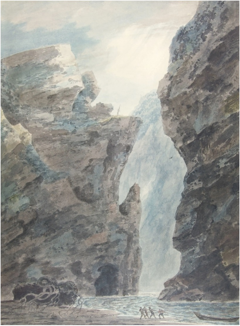
Valley of the Ober Hasli, Switzerland, 1778
Pencil and watercolour, 474 x 351 mm
Inscribed on back ‘In the canton of Bern/ Switzerland/ J R Cozens 1778’
Eton College Collection
The Valley of Ober-Hasli – Eton College Collections
Turner might also have been familiar with a composition by John Robert Cozens, versions of which survive in the Bacon collection and at Eton College, both evidently derived from an original sketch at the Fitzwilliam Museum. As yet there is no online image of the latter but I hope to post something in due course. As we have seen in the previous part (#27), Turner copied numerous compositions by Cozens in his late teens, and he would have known that Cozens made several studies in the Haslital during a visit to the area in 1776. The exact viewpoint of the present drawings remains to be confirmed but the inclusion of boatmen in the Eton College version seems somewhat fanciful. The Aare is nowhere readily navigable above Brienz and certainly not so through the gorge. Nonetheless the Aare Gorge does appear to be the likely subject: Even though access was difficult and limited prior to the construction of the through walkway, the gorges were known to travellers. Three years after Cozens visited the area, they were described by no less a figure than Johann Wolfgang von Goethe.
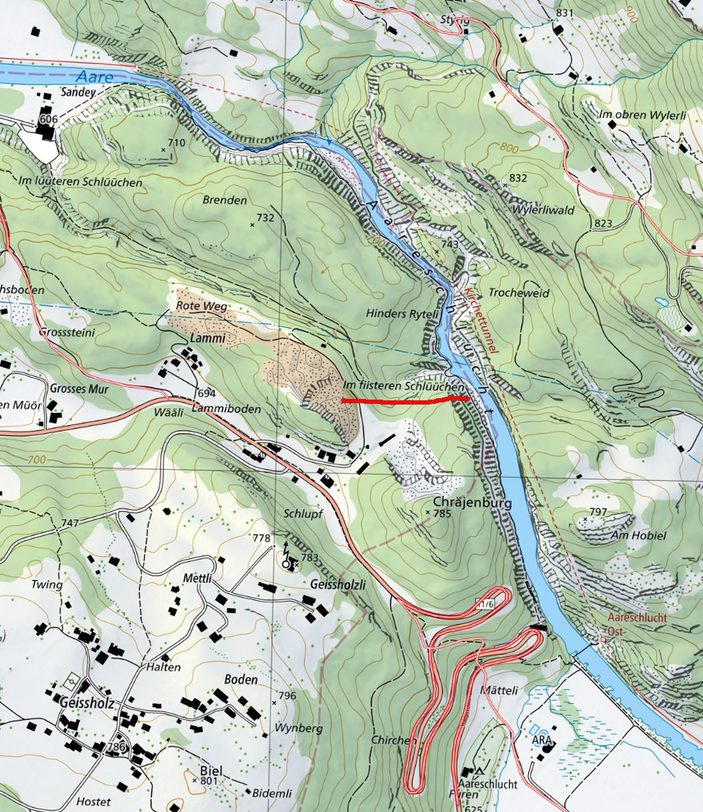
Goethe’s travels in the Bernese Oberland have been retraced by Meiringen resident Jürgen Pachtenfels. A detailed photo tour of the gorge by beyondarizona.com relates that Goethe descended to the bottom of the gorge about half-way along via a side ravine called the “Finsteren Schlüüchen”. This descends steeply from the Lammi, some way above the Kirchet on the left bank of the river. This route appears now to be lost and impassable, but it would be good nonetheless to establish a firm identification of Cozens’s subject. The visitor walkway offers a rather more straightforward platform from which to identify the distinctive rock formations in the watercolours.

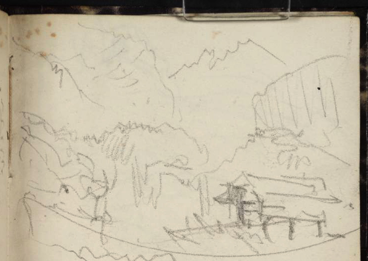
Turner was determined to record what he could of the Aareschlucht, so walked down to the covered bridge that carried the Oberhasli road over the river near the entrance to the gorge. The old covered bridge was replaced in 1858 by an iron footbridge, and the crossing survives to the present, connecting the railway station to the visitor entrance to the gorge. He began his account with a view from the road looking upstream past the covered bridge to the entrance to the gorge and then moved round to the left to take a sketch looking across the bridge to the south side of the valley, with the Engelhorns above left and the Reichenbach to the right.


Once across the bridge, the old Oberhasli road directly began its ascent of the Kirichet. Murray’s Guide describes it thus: (p.83): ‘The path, quitting for a short time this side of the river, mounts this steep in zigzags’. Brockedon’s Passes of the Alps added some picturesque detail: ‘The view of the former valley is beautiful from the ascent to this embankment; and the road lies amidst numerous beeches and other trees which remind the English traveller of similar forest scenes in England.’
Best viewed full size. On a desktop right click and open in a new tab. Close tab to return to this page
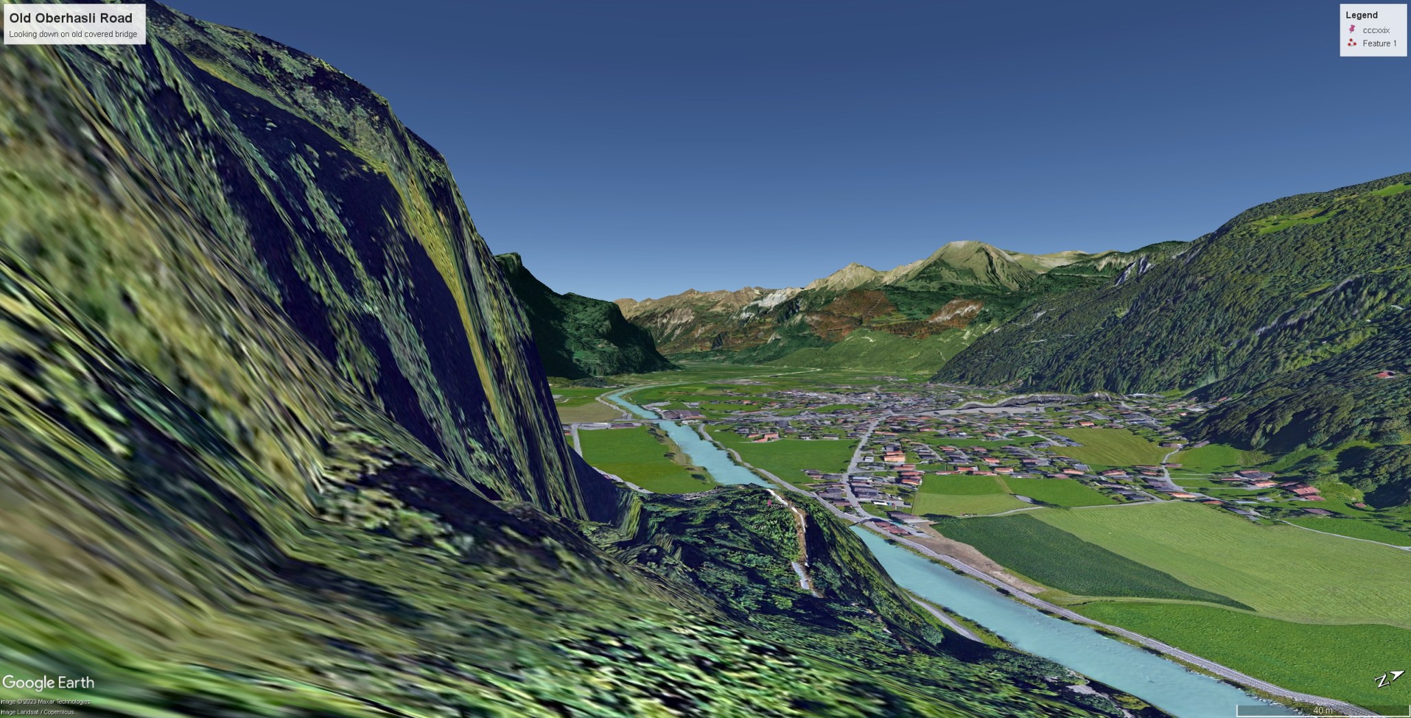

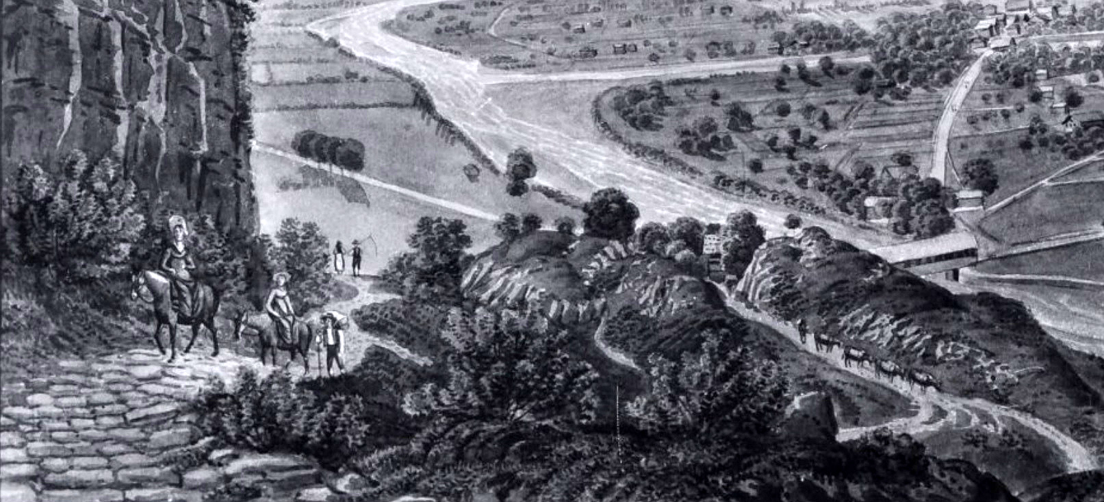
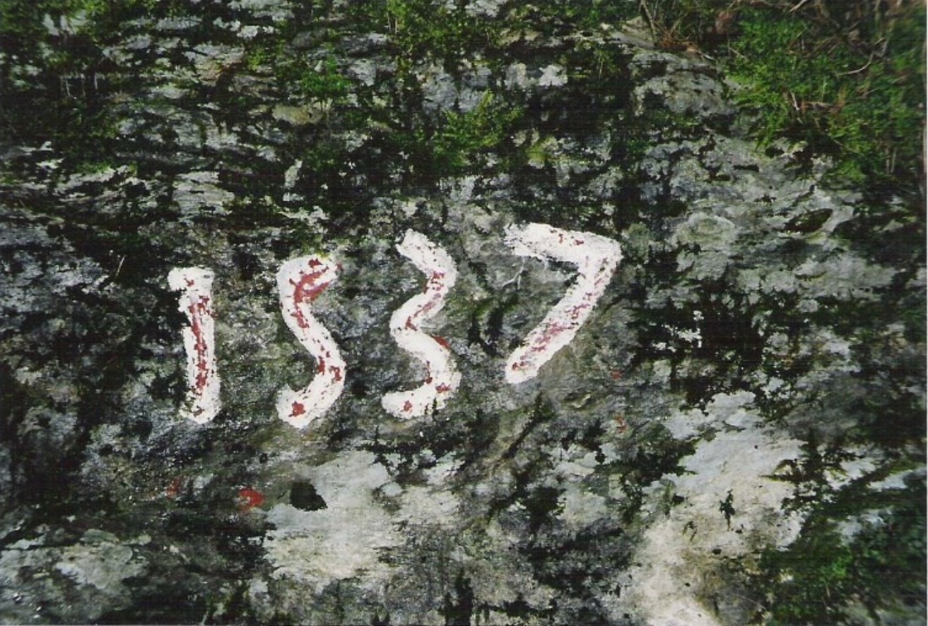
The view from the ascent is very beautifully recorded in a watercolour, a photograph of which was very kindly sent to me by Mr Walter Schmid of the Hasli Museum in Meiringen. This shows the old mule track ascending above the covered bridge. Mr Schmid further informed me that the route was built in 1537 and that a date stone survives, and that the old route is still well-preserved in parts. I hope to be able to retrace something of this in due course. This remained the principal route until 1847-8 when the new road was built along a better-graded and more southerly route plotted from a new bridge near the foot of the Alpbach torrent.
Photographs courtesy of Mr Walter Schmid of the Haslimuseum, Meiringen. Click on either image to open full-size in gallery view, and close gallery to return to this page.

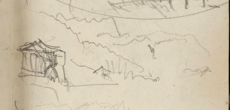
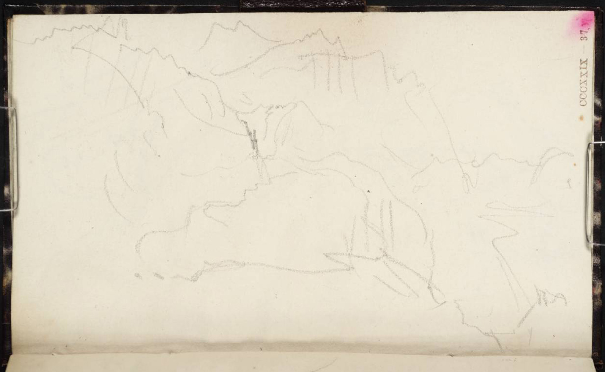
Ascending the Kirchet by the old route, Turner made a succession of sketches in both the Between Lucerne and Thun sketchbook and on his sheets of grey paper, recording the view back into the Haslital at almost every turn, from ever-higher viewpoints. It is perhaps superfluous to comment on individual examples, but it is worth observing overall that Turner now found himself in scenery that he would have known from his teens via the sketch and finished watercolour of John Robert Cozens, and that, to judge from the extraordinary attention that he lavished upon the view, he was plainly intent on paying his own tribute to the subject.
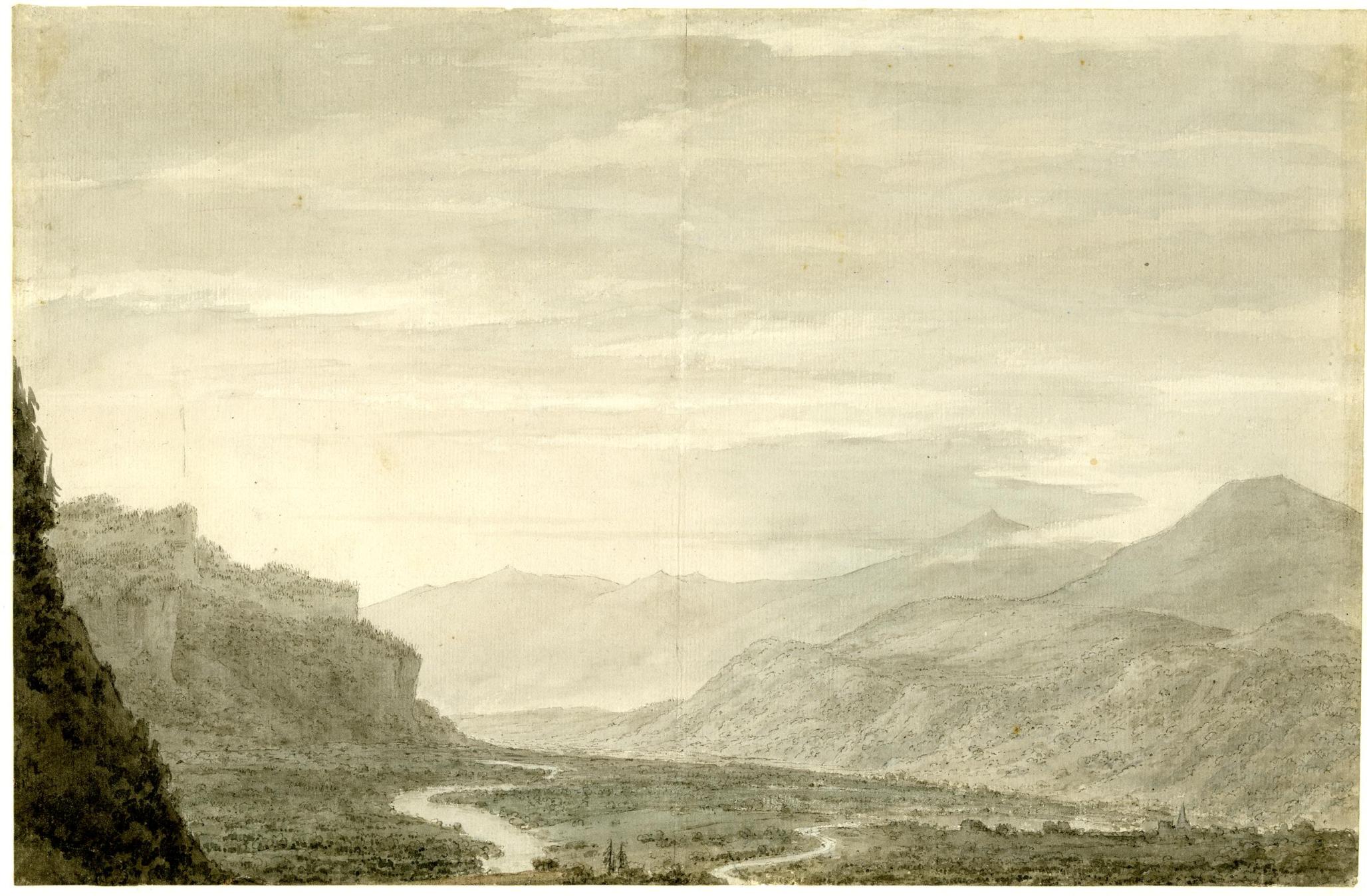
The Haslital below Meiringen from the ascent of the Kirchet, 1776
Called ‘Bern: lower part of the valley of Ober-Hasli from the SE; the Aare river winding through a broad valley plain with tall mountains on either side’.
Watercolour, 232 x 352 mm
British Museum 1900,0411.21
https://www.britishmuseum.org/collection/object/P_1900-0411-21
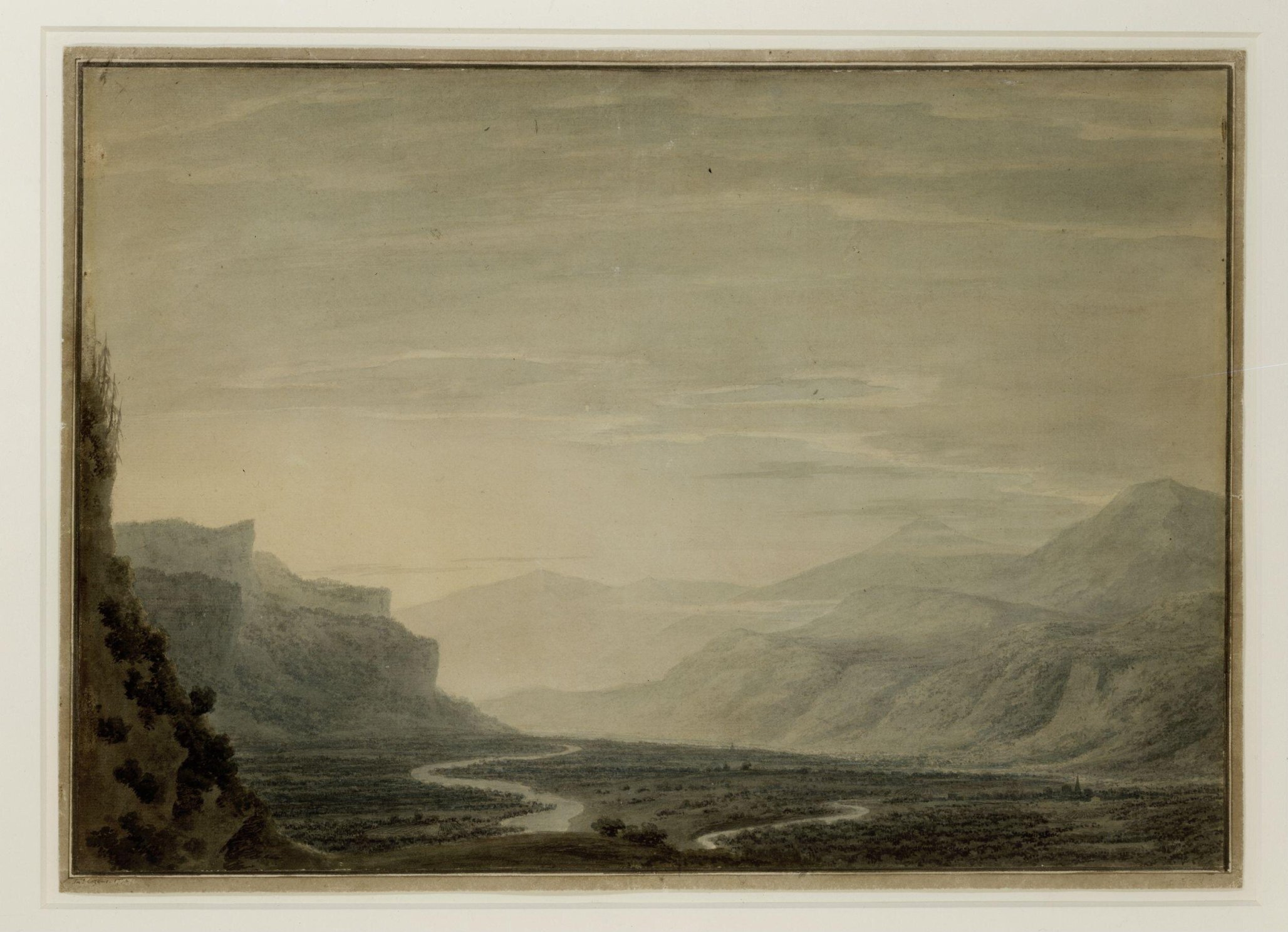
Valley with winding streams (Looking down the Haslital from above Meiringen) ?1794
Watercolour, 14 ¼ x 20 ¾ ins
London, V&A, Dyce.708
https://collections.vam.ac.uk/item/O1068856/watercolour-cozens-john-robert/
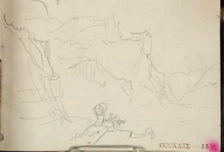
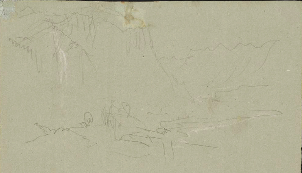


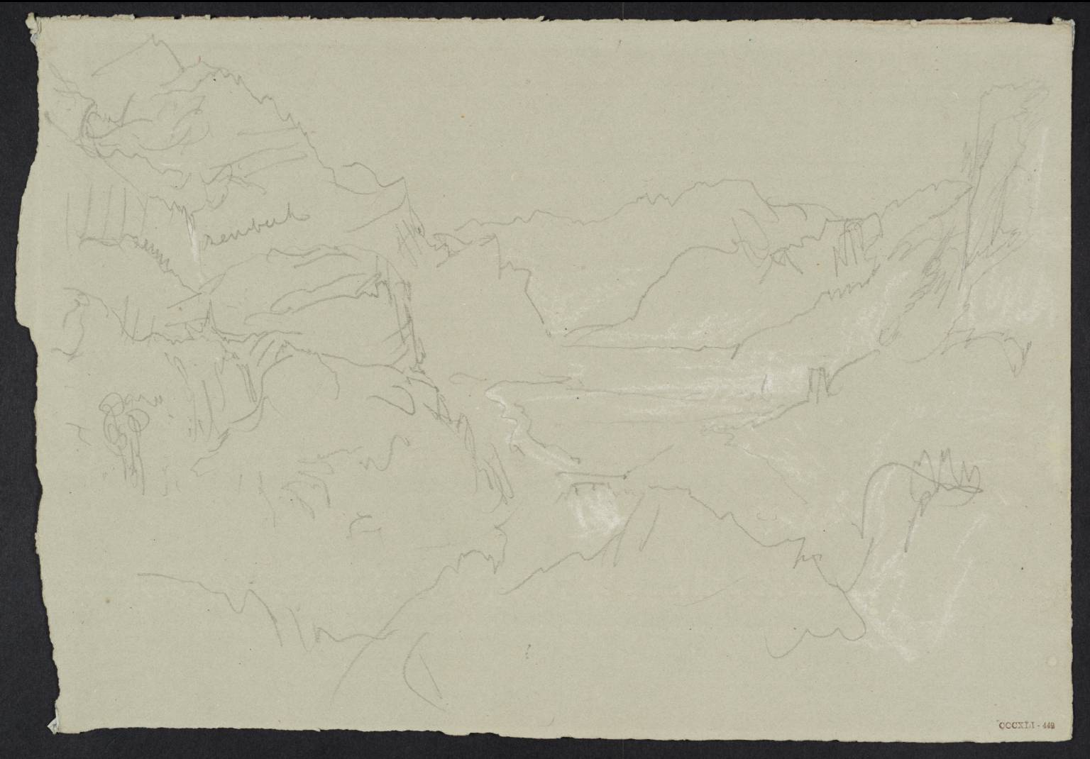
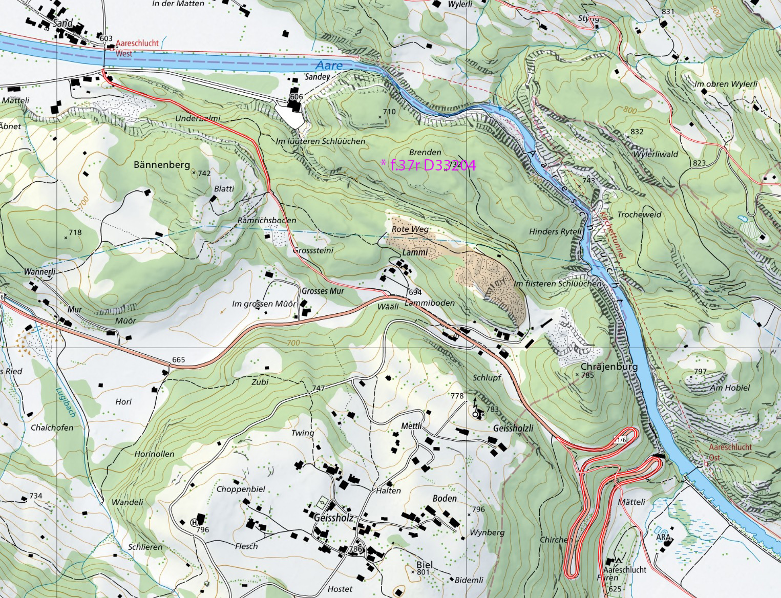
The last of these sketches is perhaps a little problematic, for it is some way off the route that has hitherto been established for the old Ober Hasli mule track. That is clearly marked on the official map of the Federal Inventory of History Transport Routes in Switzerland [IVS – Home (admin.ch)] and ran south-east to pass safely to the south of the Lammi. Turner appears to have left the usual track to pick an altogether more precarious way along the lip of the Aareschlucht. We will see those sketches in the next chapter but for now I leave you with the first real cliff-hanger to appear in Sublimesites.co.

