This is the seventeenth instalment of a tour through the Illustrations to the Life and Works of Lord Byron published between 1832 and 1834. Here we begin a mini tour through the Ionian islands, making our first landing on one of the bedrocks of Homeric poetry, the home of Odysseus.
[On a desktop screen images may be viewed full size. Right click on image and select ‘open in new tab’. Close tab to return to this page]

The Ioanian island of Ithaka lies off the west coast of Greece, roughly midway between Corfu and Zante.

Byron passed by in 1809 when sailing from Patras to Preveza on his way towards Northern Greece and Albania. He could not have thought of it but in conjunction with his reading of the Greek classics, for it was the home of King Odysseus, who in Homer’s Iliad left his young bride Penelope to go off to fight in the Trojan Wars, and then in the Odyssey took ten long years to find his way home.
Byron could not land on this occasion, for Ithaka was enemy territory, occupied by the French. Even so, given its historical and literary associations, it is a little surprising that he gives it only the briefest mention in the poem that described the tour, Childe Harold’s Pilgrimage.
Childe Harold sail’d and pass’d the barren spot
Where sad Penelope o’erlooked the wave;’

It might have occurred to him that it might be unwise to too obviously invoke the very archetype of epic journey poems lest it invite too immediate comparison with his own.
It was another fourteen years before he set foot on the island. He had accepted an invitation to travel to Greece to contribute to the Greek War of Independence.
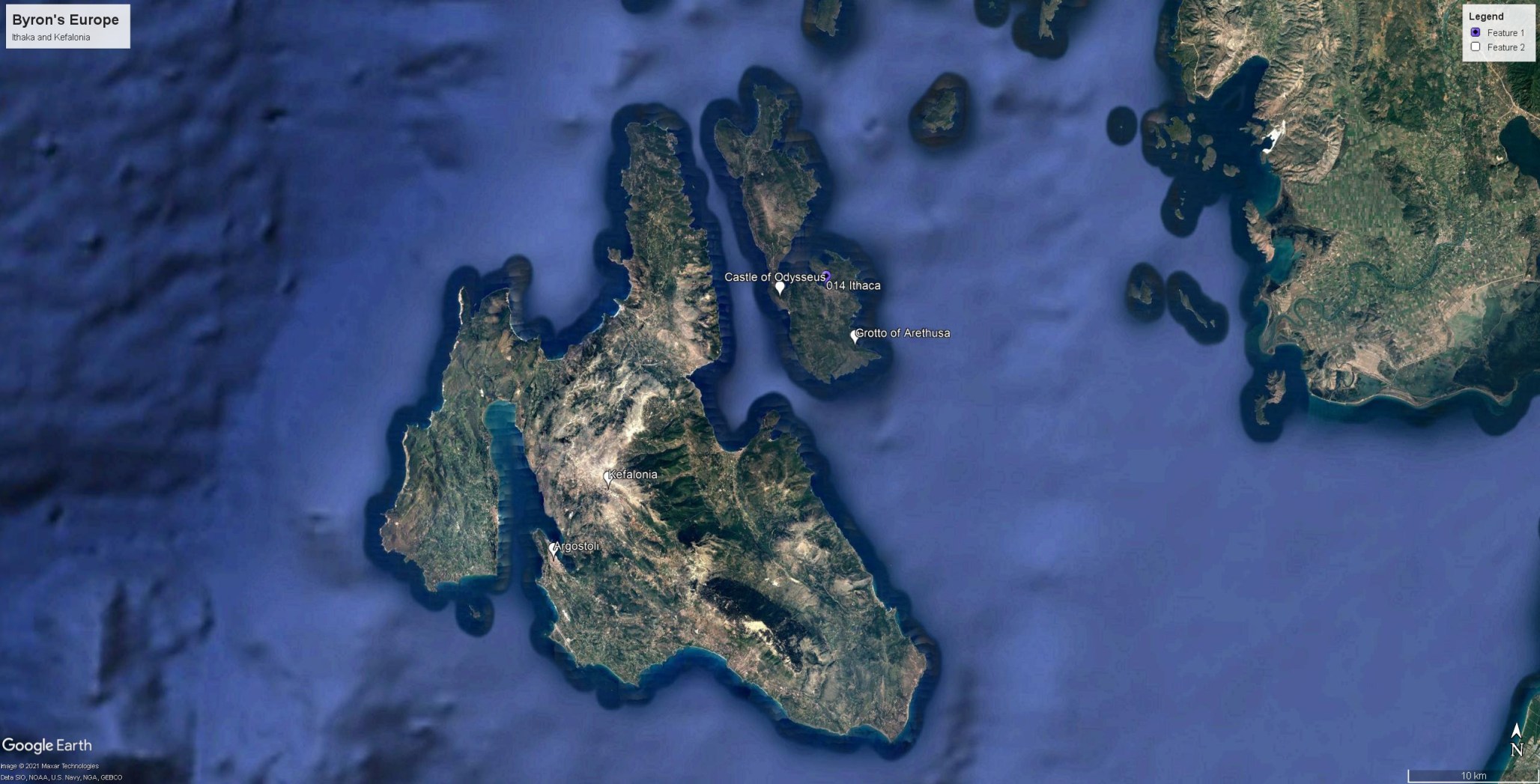
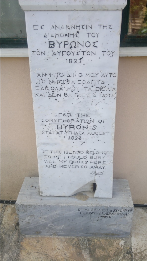
At the beginning of August he travelled from Italy to the neighbouring island of Kefalonia where he established a base to formulate a plan of action. Whilst working on this he decided to spend a few days 11-17 August 1823 in making brief visit to Ithaka. He stayed with the British Resident in Vathy, and en route visited the Castle of Odysseus on its narrow crest between the strait of Kefalonia and the Bay of Vathy. From Vathy he made an excursion to the Grotto of Arethusa, and set up a fund for the relief of the refugees in Vathy who had been displaced by the brutality on the mainland. Even today, Byron is honoured in Greece as a hero of the Wars of Independence, and there is a monument to his visit, photographed by Demosthenes AGRAFIOTIS near the folklore museum in Vathy.
The most vivid and direct report of the 1809 sojourn is that given in the diary of Bryon’s travelling companion, John Cam Hobhouse, transcribed in an excellent online scholarly edition by Peter Cochran. Byron’s correspondence is also transcribed by Peter Cochran, and the Romantic Circles website has a summary chronology of the whole tour.
Peter Cochran also has a superb collation of Byron’s final stay in Greece 1823-4, including Kefalonia, Ithaka and Missilonghi, and there is a detailed contemporary narrative of 1823 visit to Ithaka by James Hamilton Browne, who accompanied the poet on the excursion.

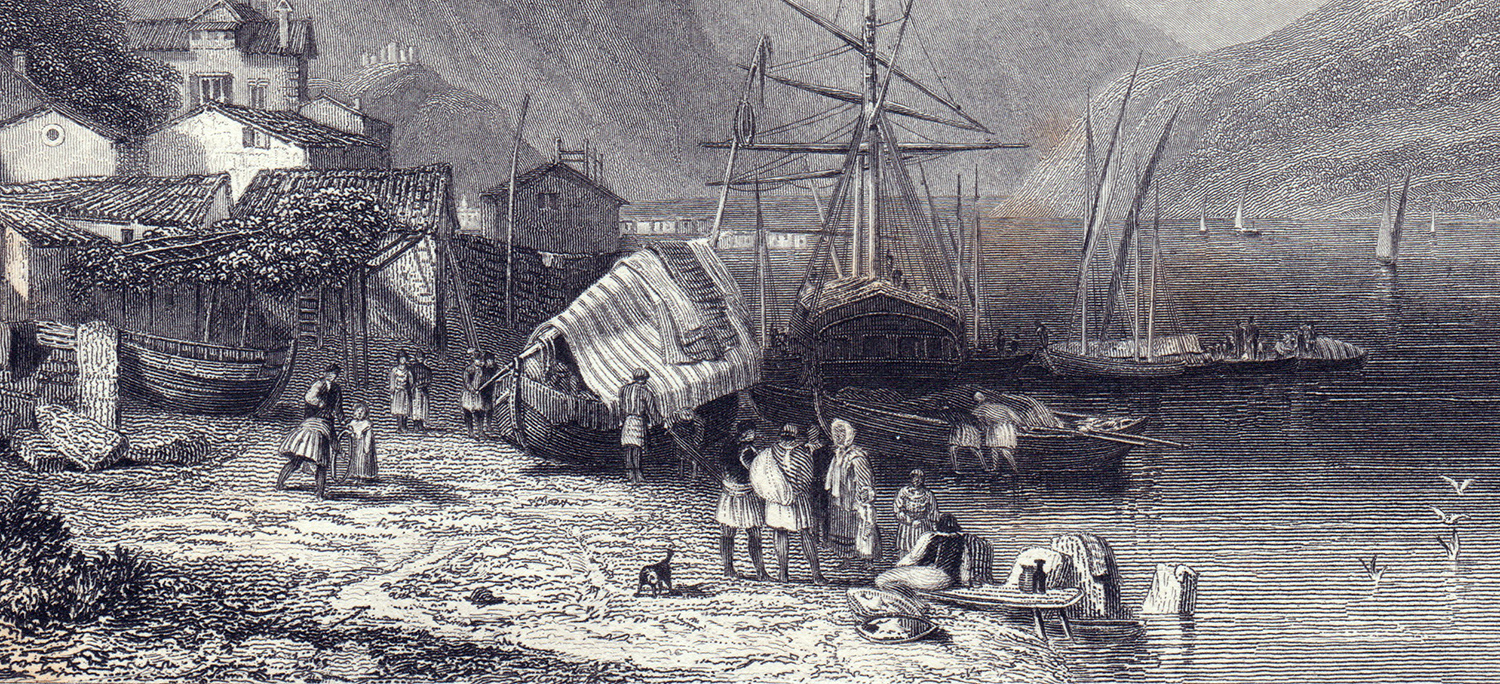
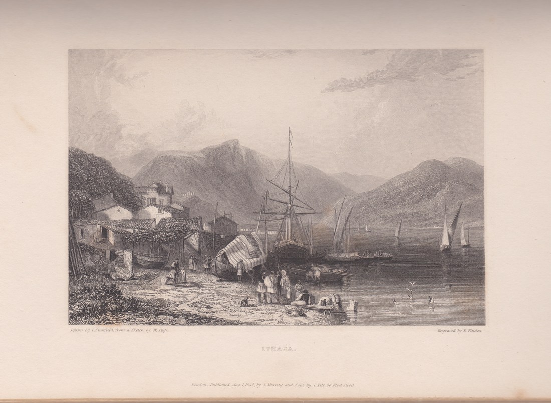
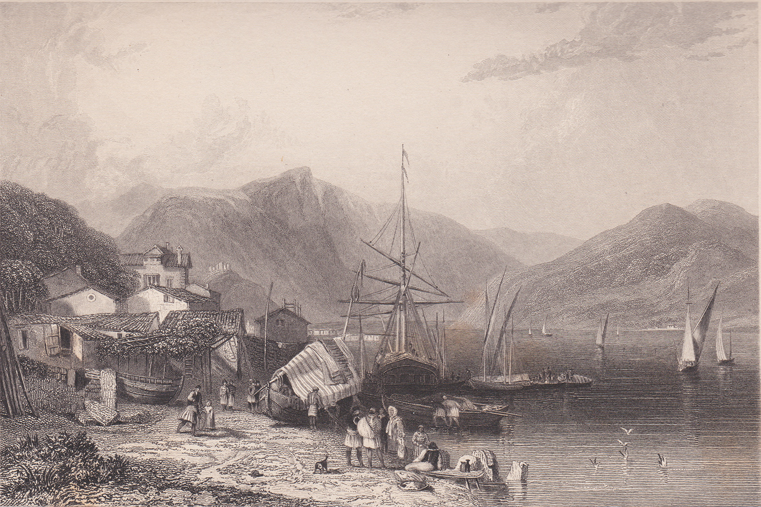
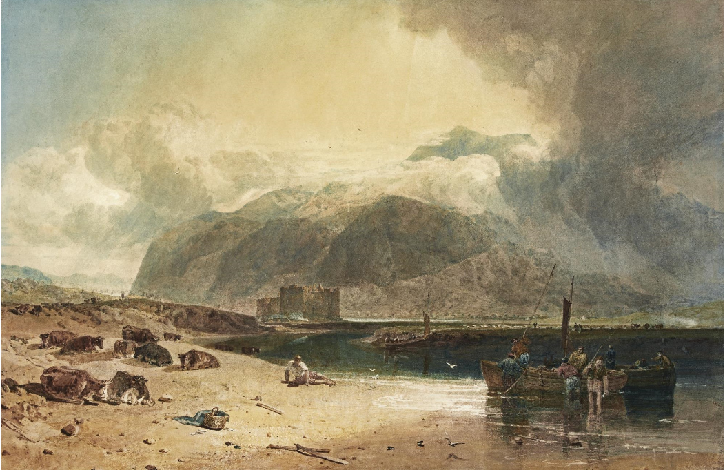
The subject of the engraving is the Port of Vathy, looking north from the quay.
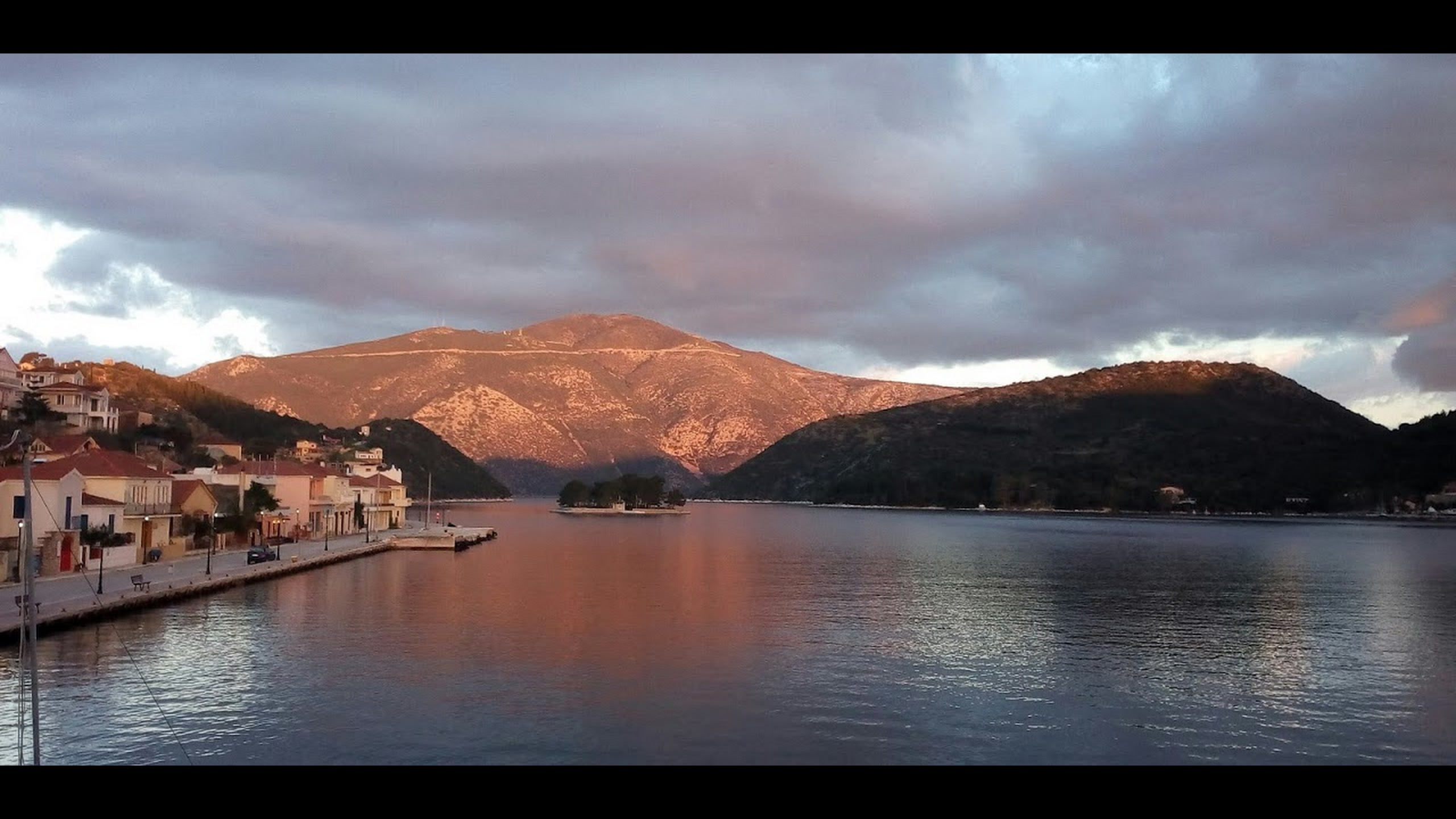
There is a beautiful comparative photograph by Natasa Vlisma on Google Earth.
The mountain in the distance is the northern part of Ithaca island with before it on a promontory to the left is a small fort built to guard the entrance to the harbour. Vathy is a wonderfully sheltered harbour, opening out into the strait between Ithaka and the mainland and sheltered by a spine of hills and the island of Kefalonia from the open sea to the west. During the eighteenth century Ithaka became something of a refuge for those fleeing Ottoman domination on the mainland, and in the years leading up to the publication of the engraving had become an important centre in which Greek independence was plotted.
Most contemporary readers would have been aware of the recent culmination of the Greek War of Independence. In 1832 when this engraving was published, Lord Palmerston, the British prime minister convened a conference of the Great Powers in London to agree the establishment of an independent Greece under their protection and under the rule of a nominee King, Otto of Bavaria. After a conference in Constantinople final protocols were drawn up in London to establish the borders of the new kingdom.

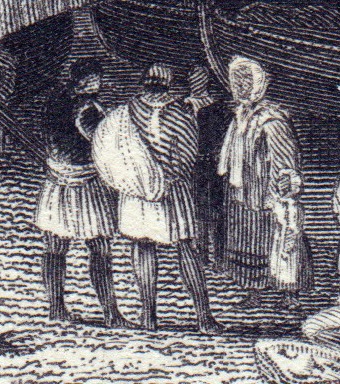
So Ithaka might well have been considered in relation to Homer, or Greek independence and even in relation to Byron’s visit whilst joining that cause, but the image makes no obvious reference to any of that. Rather it presents us with a mountain-girdled quay that might (in black and white) be Loch Fyne or Loch Linnhe, and what’s more, to add to that impression, quite a number of the figures in view appear to be wearing kilts.

It was something of a commonplace for travellers to compare Western Greece with Western Scotland with green mountains in both falling into clear, coral-sand seas. Except for the vine trellis and the feluccas, and the kilts are plain not tartan. Images of picturesque dress were a commonplace of early nineteenth century illustration so readers would have had no difficulty in recognising that most of these figures are wearing the traditional Greek fustanella.

So within the first twenty plates [this appeared as the nineteenth in sequence of issue in the subscribers’ edition] Finden’s Illustrations had established a field of view that encompassed Europe from Scotland to Greece and found the continent as picturesquely familiar at one end as the other.

Ithaka is here shown as a haven of peace, a place where children might play in safety. At the same time, with the 1832 settlement The Ionians and southern Greece had become almost coeval territory; a place to which the traveller might venture, and consider as common ground. You might even see here the beginnings of an idea that led to European citizenship. How splendid it was to share that with fellow citizens right across the continent until a few weeks ago. How quickly and silently it was spirited away. I’m still yet to hear how this is supposed to be a benefit.
Next: Lefkada
Afterthoughts.
1 What’s in a Name?
Ithaka is the first of what might be a large number of nomenclature issues. Greece is a particular problem because its proper place names are written in Greek. So this island is actually called ɪθəkə.
Translated into the modern English alphabet this is given variously as Ithaca, Ithaki or Ithaka. The engraving is titled as in the first instance, but in conformity with the general aspiration of this site to call places by locally established names, except where that would be just too confusing for most readers, I have decided to go for the last as closest to the modern Greek.
Place names, however, are a serious cultural bone of contention, and Ithaka has been occupied by a variety of cultures. Wikipedia points out
written documents of different periods also refer to the island by other names, such as:
- Val di Compare (Valley of the Bestman), Piccola (Small) Cephallonia, Anticephallonia (Middle Ages until the beginning of the Venetian period)
- Ithaki nisos (Greek for island), Thrakoniso, Thakou, Thiakou (Byzantine period)
- Thiaki (Byzantine and before the Venetian period)
- Teaki (Venetian period)
- Fiaki (Ottoman period)
And there have been Russians, French and Albanian interests in the island, possibly with names of their own. Homer, if that’s not just the final straw, called it ‘iˈθaci’. Still it’s good to show some respect for your contemporary audience, and perhaps some English speakers might still need to be reminded that ours are not the only words required in the world, however loudly you say them.
2 I really want to be there.
And that isn’t just because of lockdown. It is a shame that neither William Page’s sketch, nor Clarkson Stanfield’s watercolour is readily identifiable today, because there is an effect in the final image of eliciting a desire to actually be there, which is distinctive. It is not new to Clarkson Stanfield but is certainly a recent creation in art, and which might is some measure be attributed to Turner.
It can easily be demonstrated in a comparison. The British Museum has an 1801 drawing by Sir William Gell that records almost exactly the same view.

https://www.britishmuseum.org/collection/object/G_1853-0307-63
This certainly has the effect of suggesting that the artist was actually there, but does no more than provide a schema of what forms presented themselves to the eye.
Turner’s contribution [perhaps not his alone, but certainly his in quality and characteristic] was to represent the sense of being at that place. So there are nuances of tone and atmosphere, local particularities, instantaneous phenomena and sensations, of the kind that only being rather than imagining or knowing can give. That was the aspect in which most of the artists that contributed to this series followed Turner, sometimes approaching him in this case approximating to a quality of effect that Turner had trademarked more then quarter of a century previously.
J.M.W.Turner, Kilchurn Castle, Loch Awe, 1802, Sotheby’s, London, 5 July 2017, lot 175
By the 1830s, however, as we shall see Turner had moved on to the deeper languages in which being there might speak.
