Here we continue our journey through Turner’s Between Lucerne and Thun sketchbook. Having completed in the previous pages a survey of the lake shore and the town walls, Turner returns to the subject sketched on the very first page.
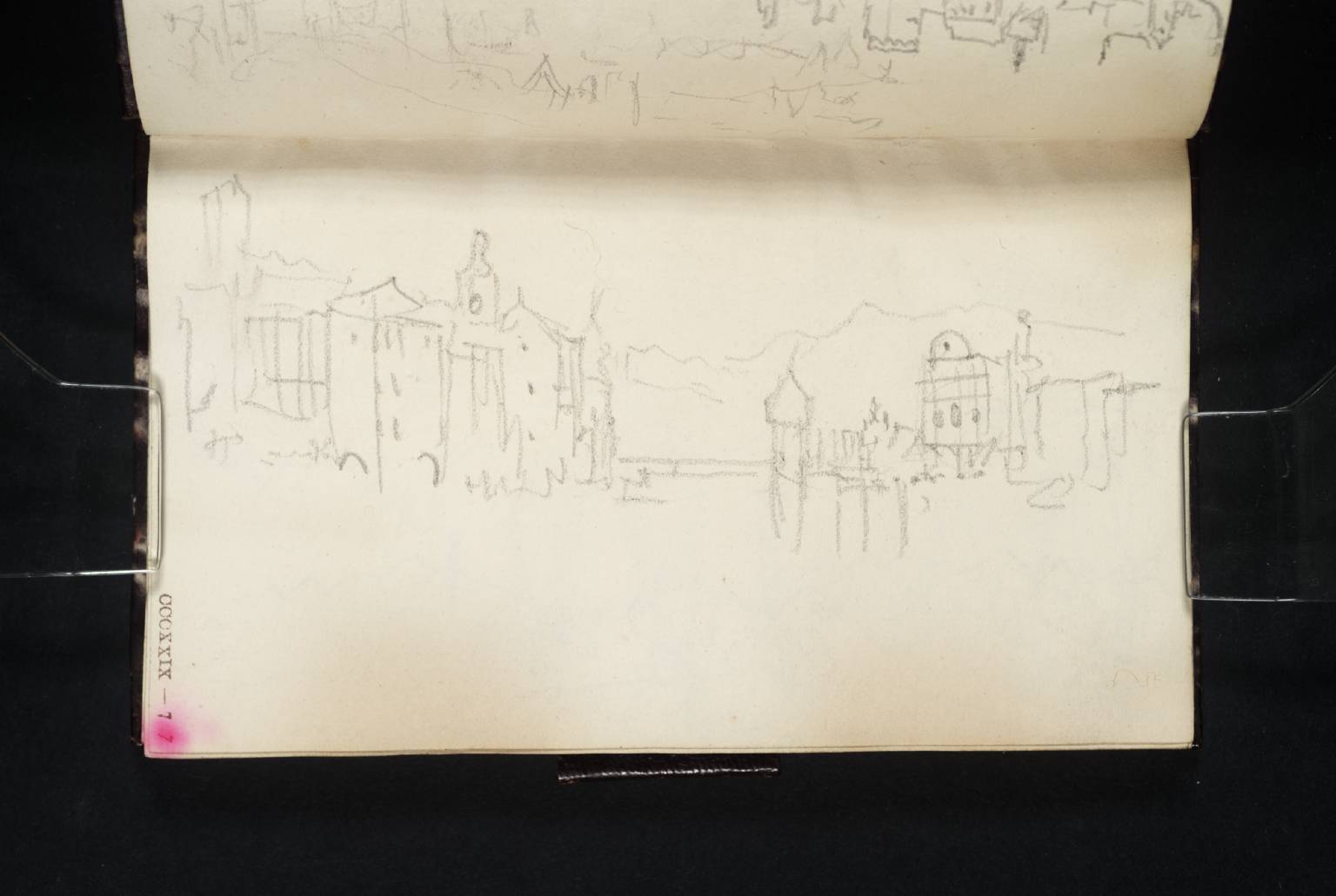
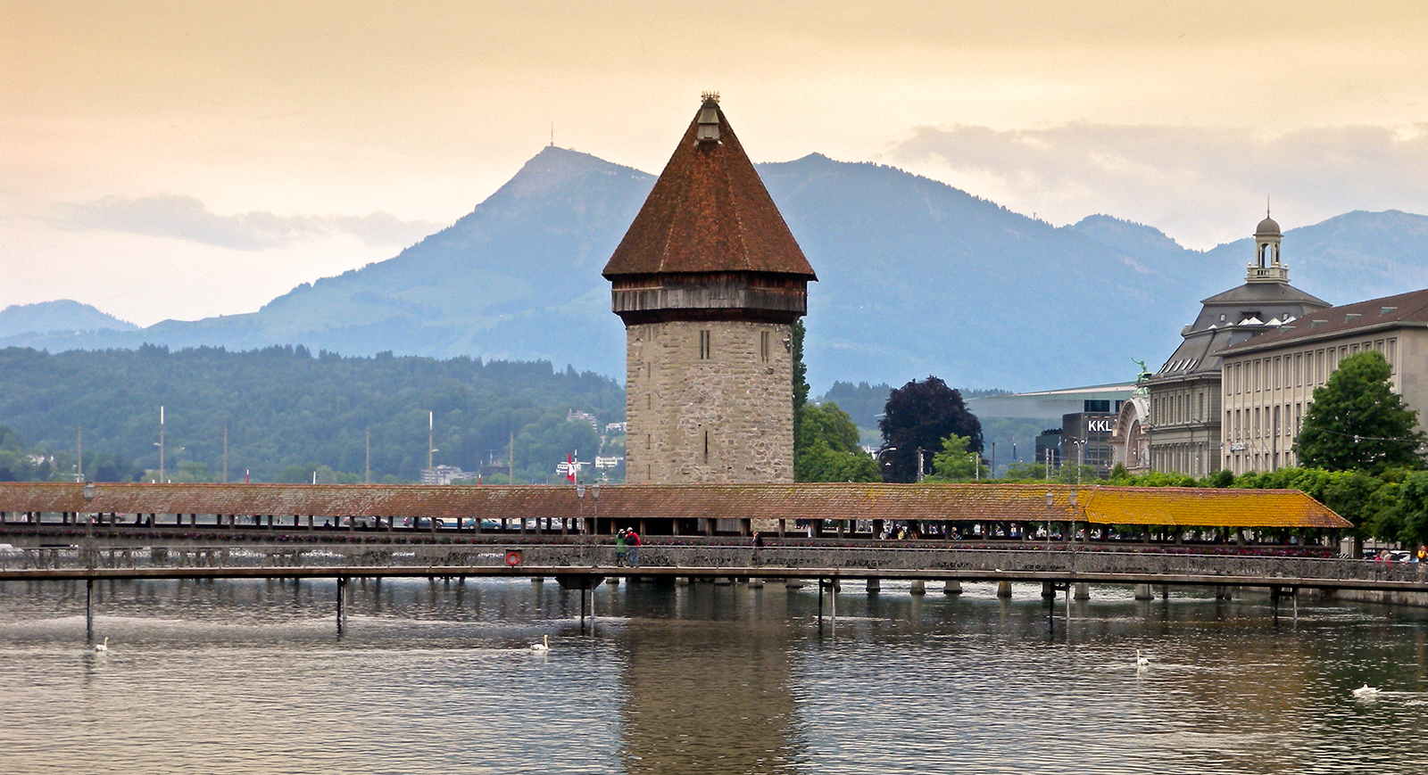
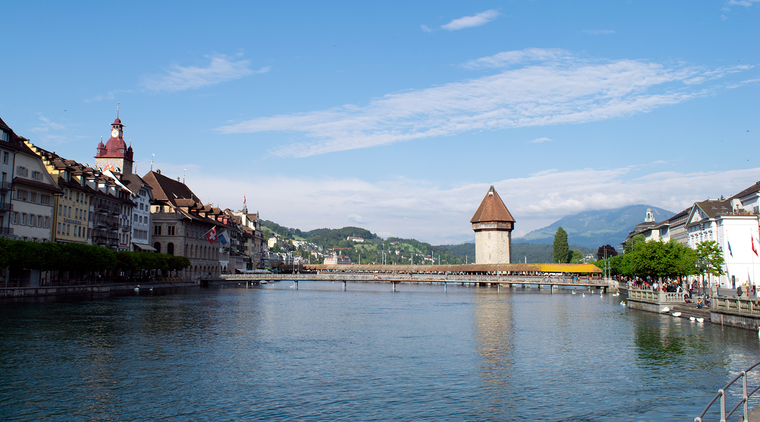
This is a quick panorama of the view from the Reussbrucke looking upstream to (from left to right), the Zytturm, Clock Tower, Kapellbrucke, Wasserturm and Jesuit church.
[On a desktop, right click image for option to open full-size in new tab. Close tab to return to this page.]

I wrote about this subject at length in a SublimeSites.co article of 2014. The principal subject there is a watercolour of Lucerne: Moonlight at the British Museum.
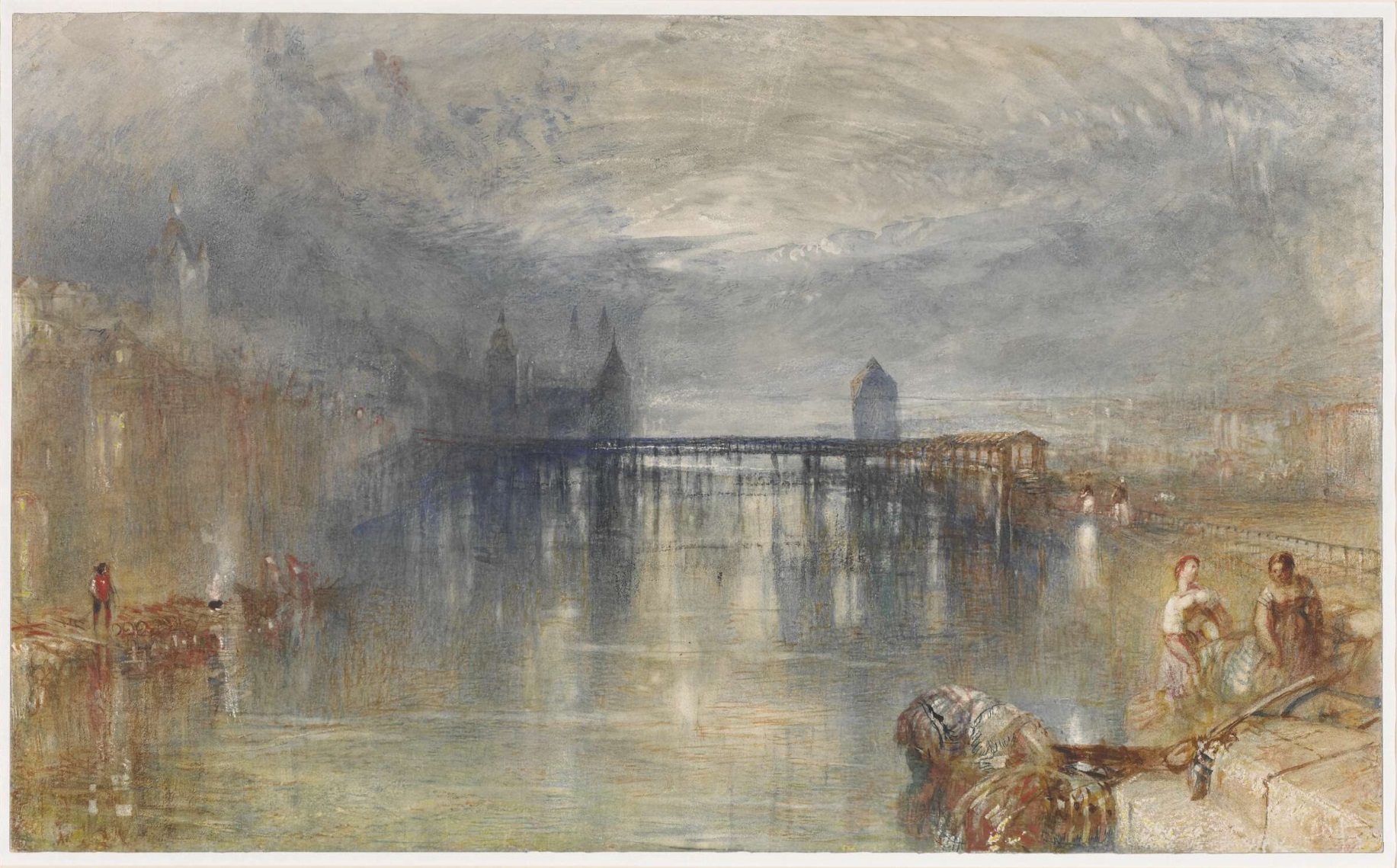
This treats the view of the Kapellbrucke and Wasserturm from outside the Jesuit church. This appears to synthesise material from several sketchbooks, and the related sketches [*see note below] are discussed in detail there.
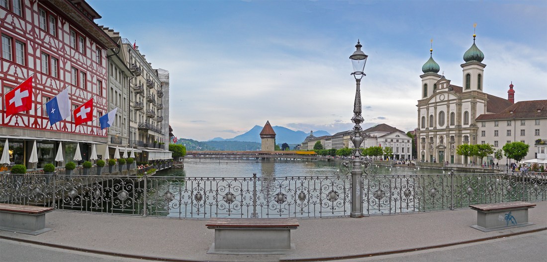
Here, we might give further consideration to the complications in the present sketch. At first sight it appears to be unproblematic, but the material cannot be seen from any single point of view.
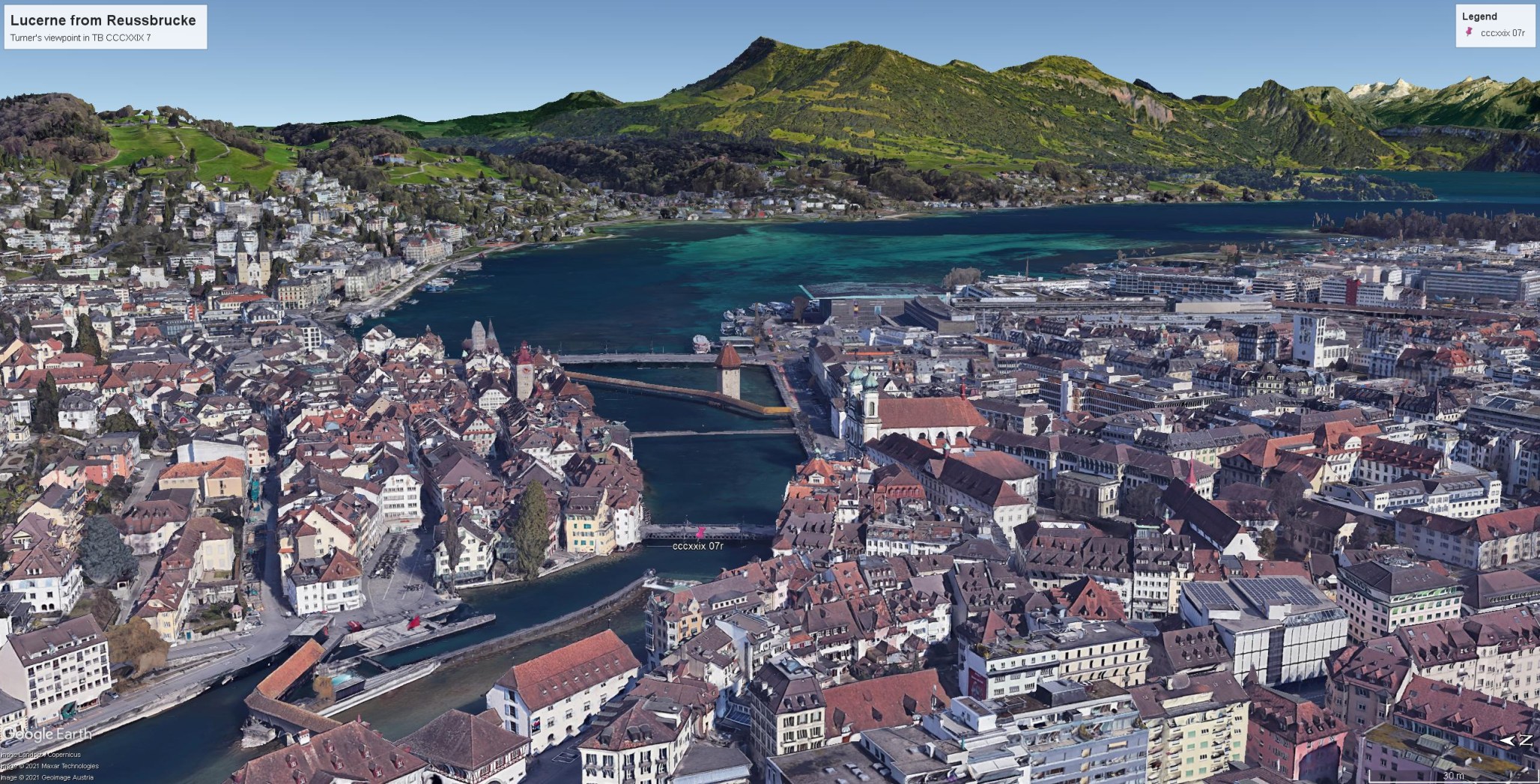
The Zytturm may just be glimpsed from one spot a few feet downstream of the Reussbrucke where it appears framed in tiny gap between the buildings of the Kramgasse. Richard Chapman has a photograph on Google Earth which is taken from the perfect spot. I hope he will not mind my sharing his work with you here.

But to see the Zytturm above the intervening buildings so clearly as in this sketch appears to require a viewpoint several stories above ground level. Likewise the way in which the Rigi appears above the Wasserturm also requires an elevated point of view. Yet this is incompatible with the general angle of view which appears to be otherwise all at ground level.
The view of the Zytturm, Clock Tower, Wasserturm and Rigi are all taken from a point of view at the south end of the Reussbrucke.

The view of the Jesuit church, however, is from the north end of the bridge; from the line of view at the south end of the bridge it is seen more obliquely, or is hidden altogether.
To find Turner synthesising differing viewpoints into the same sketch is not in itself unusual. There are instances of this event from his early career [I discussed such an instance in a 1797 sketch of Stamford, Lincolnshire in Turner in the North, 1996, pp.176-77] but to synthesise differing heights is more perplexing.

I can only surmise that he must have gained access to a building at the south end of the Reussbrucke, but it will take some expert local research to establish how plausible a suggestion that might be.
*Related sketches of this subject in other sketchbooks:
One very scrappy and hasty treatment in the Lucerne and Berne sketchbook TB CCCXXVIII 2v, possibly of 1841. Others, more careful, amongst a group of small sketches in the Lake of Zug and Goldau sketchbook TB CCCXXXI, 28r and 28v, probably of 1841 or 1842, and another, possibly the earliest in the sequence, on a loose sheet of grey paper, TB CCCXLI 384.

Next: Farewells and departures.

2 thoughts on “In Turner’s Footsteps between Lucerne and Thun: #10 Lucerne; back to the Wasserturm”